Emlid @emlid
Emlid makes RTK receivers Reach for survey and mapping. Reach comes with an app for iOS and Android for data collection. Tag @emlid to get featured. emlid.com/main Worldwide Joined February 2014-
Tweets1K
-
Followers2K
-
Following121
-
Likes1K
Six property pins, no fix in three years. Emlid’s Reach RS4 and RS4 Pro fixed all six, within 3 cm of the plans. Here’s how all-band tracking gets you out of float under canopy: blog.emlid.com/gnss-accuracy-…

Different crews, different habits, different results? Fyfe’s surveyors share the same projects, settings, and code libraries in Emlid, so every crew works to the same standard on every job. Here’s how they built it: blog.emlid.com/customer-story…

Not enough surveyors to go around? At Hausmann Construction, superintendents now handle their own layout, stakeout, and grade checks on site with Emlid. Here's how they set it up: blog.emlid.com/customer-story…

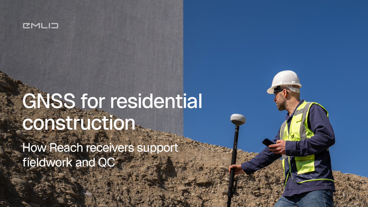
Check pads, grades, and utilities on every lot with the Emlid GNSS rover with no wait for a surveyor. We explained how it works for each stage of a residential build: blog.emlid.com/GNSS-for-resid…
AR stakeout on the Reach RS4 Pro shows the point right on the ground under your pole. See how it works, from the engineer who built it: blog.emlid.com/ar-stakeout-re…

Emlid is heading to INTERGEO 2026 in Munich, Sept 15–17. Come by booth B6D053 to test the Reach RS4 Pro, catch live workflow demos, and hear CEO Igor Vereninov on the main stage. Book a demo: share-eu1.hsforms.com/2FjLiFUenTca5t…



Not all utility data is created equal. ASCE 38 gives you four Quality Levels, from record research to physical exposure. Here's how RTK GNSS fits into each one → blog.emlid.com/ASCE-38-x

If your utility as-built survey keeps getting kicked back, it’s likely a missing datum, late capture, or incomplete attributes. Nail these four requirements and get the approval the first time: blog.emlid.com/utility-trench…

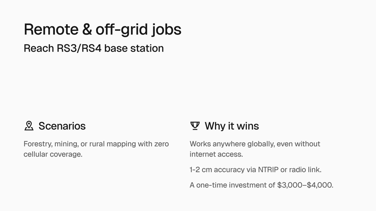
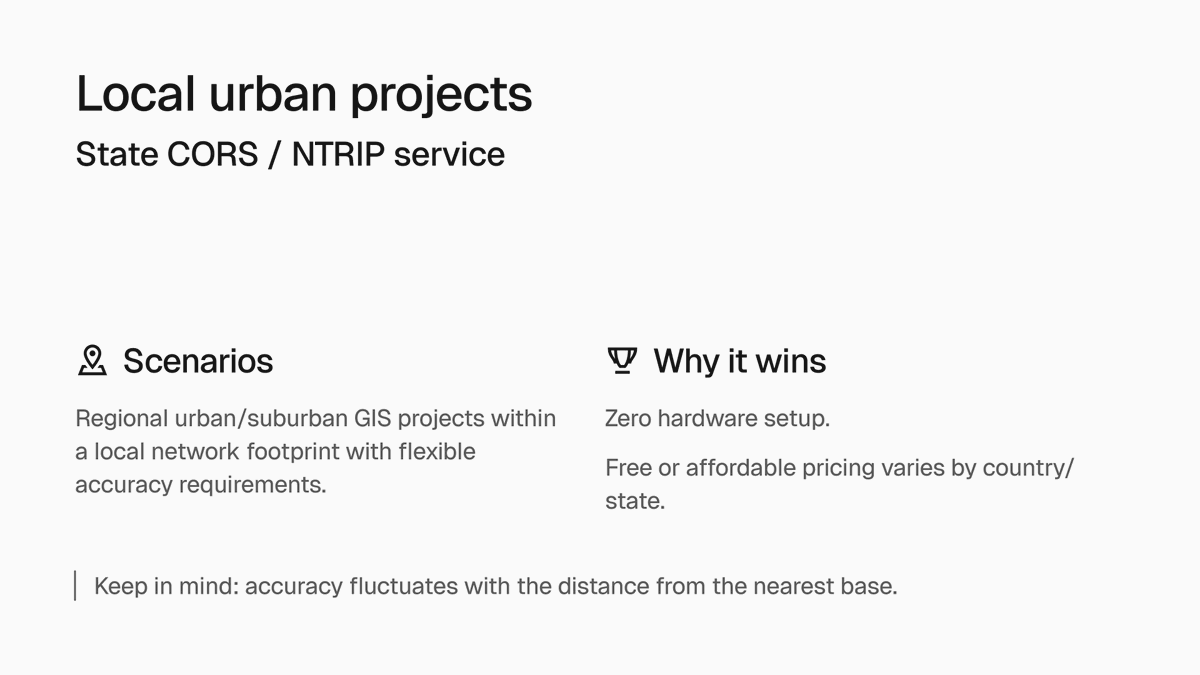
Do you really need a base for your next project? Swipe to find the best correction source for your workflow. Emlid Corrections: urban & multi-site projects with internet access. Reach base: remote sites, even without internet. State CORS: Local, urban areas with internet coverage


Centimeter accuracy—right out of the box. Emlid Corrections is here: activate in Emlid Flow and get 1–2 cm in seconds. No base station, no NTRIP setup. Powered by @pointonenav network. First year free, for your current and future fleet. Check coverage emlid.com/corrections-x
A set of anchor bolts sat 6 inches off—caught before the pour, not after. All due to CORE Construction putting Reach receivers in superintendents' hands to check layouts themselves. Read how: blog.emlid.com/core-construct…

Level the pole at every point, or lean it toward the target and keep walking. The Reach receivers with IMU tilt compensation make the second one just as accurate. Explore how it works in the field: blog.emlid.com/imu-in-surveyi…

A layout point can move between the surveyor's visit and the next check. That gap is where rework hides. Here's how Dellbrook closed it with Emlid Reach + Emlid Flow: blog.emlid.com/customer-story…

Most earthworks overruns are preventable. Our new guide shows how to keep the whole workflow on one data chain, from the first terrain survey to the final as-built, so cut/fill, grade checks, and QA stay connected: blog.emlid.com/earthworks-pla…

A European geophysics and geotechnical firm switched to Emlid Reach across 26 offices without losing its team. Here's exactly how they did it, and how you can do it too: blog.emlid.com/switching-gnss…

One rule for utility as-builts: collect everything before the trench closes. Reach RS4 + Emlid Flow → points, attributes, and photos in a single project. Synced to the office automatically. Get the full guide: blog.emlid.com/as-built-x

Three places construction teams lose money without noticing: 1. Rework from layout errors. 2. Crews and machines sitting idle waiting for a surveyor. 3. Quantities invoiced from estimates that get disputed. We broke down how to fix this with GNSS tools: youtube.com/watch?v=Z8FyPJ…
Patriot Environmental maps frack ponds with photogrammetry and bathymetry. To get surface and subsurface in one survey, they use Reach receivers, a DJI drone with a sonar, and Starlink to connect both over NTRIP. Swipe to see how it works.


See you at Hillhead 2026, UK! From June 23–25, come meet the Emlid team at Stand RD16. Get hands-on with our latest RTK GNSS receivers with AR stakeout workflows. Book a real-life demo: meetings-eu1.hubspot.com/jnorton/hillhe…

With Reach and Emlid Flow, anyone on your site can verify grades in real time. Walk your pad with a Reach rover, open the app, see cut/fill instantly. See how it works in real life → blog.emlid.com/cut-and-fill-c…


DroneDeploy @DroneDeploy
35K Followers 750 Following The robotics and AI platform used on over 3 million sites worldwide. Book a demo with an industry expert👇
Chris Anderson (in Ba... @chr1sa
176K Followers 3K Following Occupy the skies Past in drones, airtaxis and media. Present in AI+Science. Also nerdy autonomous car racing hobby at @DIYRobocars Photo by @chrismichel
julien ANCELIN @complementterre
949 Followers 197 Following admin SIG & Géolocalisation, Docker addict, agriculture & océan, DIY & OpenSource #CentipedeRTK #INRAE
pix4d @pix4d
21K Followers 1K Following Professional photogrammetry software for mobile and drone mapping. https://t.co/i7a8nuzrYZ
Develop ESPrtk @esprtk
1K Followers 3K Following https://t.co/7IezQMKa2S 📡🛰🚜 High quality GNSS-RTK positioning solution on low cost ESP32. MQTT+NTRIP+WIFI+Bluetooth+LoRa+IMU+OLED-3/4GLTE. Ublox Skytraq Drotek Ardusimple
sUAS News @sUASnews
43K Followers 2K Following Unmanned Aviation,fixed wing and rotary UAV stories from around the world.
PYXIS Robocar @ExplorerRobocar
960 Followers 760 Following 4G/LTE Robocar, which is going to become more and more autonomous... Developed by @Stephane_Querry
Laan Labs @laanlabs
15K Followers 4K Following We create compelling experiences specializing in Computer Vision, Machine Learning, and Mobile. DMs open
Jonathan Dyer @dyerjonathan
7K Followers 6K Following Christian. Teachers Husband. Dad of 4. Grain producer & Nuffield Scholar. Using data to make my farm more profitable, productive and sustainable.
Raymond @Raymond1262474
285 Followers 2K Following

staer sstar @SstarStaer83550
40 Followers 1K Following
Federico pereyra @Federicope5x
49 Followers 666 Following
Ahmed Abomarwan @ahmed_abom85604
2 Followers 49 Following
Johnninink @Johnninineeeee
34 Followers 1K Following
o G @nerDan62181
27 Followers 505 Following
Said AbdelMoneim @SaidAbdelM1095
82 Followers 2K Following
Elifcan Sunar @elifcan_sunar
1K Followers 6K Following Protohistorya ve Önasya Arkeolojisi #DengeZamanSevgiMüzikDoğa ⚖️⏳ 🤍 🎼 🍂 🍃
Abol Mousavi @AbolMousav67361
38 Followers 872 Following
Mark Chen @59y4CNNUoChg2GY
2 Followers 83 Following
Theo panther @Theopantheag
28 Followers 307 Following
Kana @kana_cgpcpgm
998 Followers 776 Following On inexpensive scanning methods and tools in visualization.

MOSLUM @mohame9417m
49 Followers 3K Following
예슬지킴 @seeyaya112
31 Followers 218 Following
Sergio Raul @SergioRaul_hl
169 Followers 1K Following
bird strone @birdstronewqg
121 Followers 420 Following
Hernani Serodio @her82702
47 Followers 1K Following
contentderon @contentderon
126 Followers 2K Following
Wyeb td @Wyebtd
158 Followers 3K Following
Jabulani Nathaniel @Jabu_Nathaniel
30 Followers 3K Following
فحل الفحول �... @mdsyf618010
492 Followers 4K Following
Szèx @jnos7vtw
481 Followers 7K Following
اجتماعي @yj8tw
120 Followers 2K Following
Hseean Adeel @AdeelHseea73619
0 Followers 52 Following
lutflover @lutflower761494
172 Followers 2K Following

GSCSEVER @GSCSEVER3hv3
2 Followers 13 Following
Raúl Jiménez @LuarJimRam
5 Followers 245 Following No se puede enseñar nada a un hombre, sólo se le puede ayudar a descubrirse así mismo. Galileo Galilei
Lost Clash @LostClash76257
45 Followers 3K Following
Bshool90.69 @Nycebryce4u
313 Followers 482 Following
geoniderivo @geoniderivo
39 Followers 1K Following
نیلو جانxxxxxx... @uxletxxxxxx
54 Followers 2K Following
alexmaometetão @CVisnadi34544
3K Followers 5K Following
jussslow @jussslownxvl
1 Followers 112 Following
John @Johnlw1e
0 Followers 25 Following
Shannon Shannon @ShannonSha4027
1K Followers 4K Following
عيونك حلوين @cwxfdx
32 Followers 1K Following
Dr. Dex @DrDex_
2K Followers 8K Following
gwrg @gwrgn7yv
126 Followers 4K Following
Pravesh Kurmi @PraveshKur6976
0 Followers 2K Following
t @tc4tbw
18 Followers 1K Following
حسین @morsh1395
23 Followers 2K Following
Cameron Crayon @CameronCralk1y
2K Followers 7K Following
Misac Olvera @MisacO10454
9 Followers 447 Following
جميل حداد @HdadJmyl30650
326 Followers 7K Following أنا رجل من سوريا مقيم في اسطنبول ٣٤سنة ارمل اعشق ممارسة
Shamsuu Ra'uuf @RaUuf50998
0 Followers 179 Following
🤍✨ @rfzo56
9 Followers 548 Following
DroneDeploy @DroneDeploy
35K Followers 750 Following The robotics and AI platform used on over 3 million sites worldwide. Book a demo with an industry expert👇
Qiusheng Wu @giswqs
55K Followers 4K Following Associate Professor @UTKGeography | @Amazon Scholar | Talk about #opensource #geospatial #dataviz #GeoAI
Kurt Menke - @geomenk... @geomenke
8K Followers 2K Following Danish Resident 🇩🇰 | @SeptimaDK | FOSS4G user/advocate/educator | Author: Discover QGIS 3.x 2nd Ed. | Co-author:QGIS for Hydrological Applications 2nd Ed.
pix4d @pix4d
21K Followers 1K Following Professional photogrammetry software for mobile and drone mapping. https://t.co/i7a8nuzrYZ
Brendan Schulman @dronelaws
18K Followers 394 Following Drone enthusiast. Tech policy nerd. VP of Policy & Gov Relations @BostonDynamics. Former VP of Policy at DJI. Personal views only. Also find me @RobotPolicy
Laser Scanning Forum @LaserScanning
5K Followers 43 Following A leading industry online knowledge base that has grown to become a trusted and influential resource worldwide, for anyone. Supporting knowledge transfer.
Ana Ramos @RamosAna96556
1 Followers 1 Following
Eric Gakstatter @GPSGIS_Eric
3K Followers 111 Following I live in the world of high-accuracy GNSS/GPS, GIS, UAVs. Esri mobile GIS experts. Wrote for GPS World/Geospatial Solutions for 10+ yrs. FAA Pilot. Tesla owner.
Kuker Ranken @KukerRanken
89 Followers 17 Following Kuker Ranken is the Northwest's Land Surveyor, Architect, and General Contractor supply resource.
ImpulseRadar @ImpulseRadar
62 Followers 5 Following At ImpulseRadar, we make incredibly modern and advanced ground-penetrating radar solutions that are very user-friendly. #impulseradar #groundpenetratingradar
Bigman Geophysical - ... @learngpr
4K Followers 2K Following Global supplier of training, technology, and project support for companies providing concrete/structural inspection, utility mapping, & engineering geophysics
Unmanned Tech @UnmannedTech
2K Followers 186 Following UK drone parts shop Your talent for finding trees is our business plan 🌳
Innovelec Solutions @InnovelecSolut1
64 Followers 111 Following The latest emerging technologies. We select and deliver world-class semiconductors, sub-assemblies, plug-in boards and total solutions from around the world.
3DXR @3DXR_drones
60 Followers 126 Following
MURCIADRONES @murciadrones
54 Followers 116 Following Tienda de Drones en Murcia. Cursos de drones, servicio técnico, mantenimiento de drones, trabajos aéreos.....
HelixNorth @Helix_North
906 Followers 890 Following Desarrollo de soluciones aéreas para la captura masiva de datos
ATyges @ATYGES
880 Followers 248 Following Ingenieros y consultores de ingeniería. Fabricamos #drones con soluciones integrales para uso civil. Distribuidores oficiales DJI Enterprise, EMLID y PIX4D.
SOM Survey Instrument... @SomSurvey
16 Followers 1 Following We know that surveying instruments have become unnecessarily expensive. That is why we supply the most powerful, cost-effective surveying instruments around.
Ghostysky @Gh0stysky
25 Followers 115 Following Portuguese based company providing Aerial and Ground Robotic solutions in terms of products and services.
Apglos @Apglos_EU
265 Followers 484 Following We are all about making GPS land surveying easy. We did that by developing Apglos Survey Wizard. Here we will tell you tips on how to land survey the easy way.
TopoEquipos mx @MxTopoequipos
7 Followers 5 Following Somos una empresa apasionada en nuestra labor, que es orientar y capacitar a los usuarios de equipos topográficos.
Max3Design de México @Max3Design
8 Followers 6 Following Desde nuestra fundación, Max3Design se ha establecido como líder en el suministro de tecnología GNSS y soluciones de geoposicionamiento de vanguardia.

Aonic @AonicGroup
80 Followers 56 Following Building a future-proof ecosystem of solutions that propels traditional industries forward. #Oryctes #MistDrone #Airamap
Aprflytech @Aprflytech
2 Followers 1 Following
Jual Alat Survey #1 -... @indosurta_
81 Followers 832 Following Twitter resmi Indosurta Group. Indosurta Group adalah Pusat Jual sewa service dan kalibrasi alat survey #1 di Indonesia dengan 12 cabang.
Halo Robotics | Distr... @halorobotics
114 Followers 4 Following AUTHORIZED DISTRIBUTOR DJI Enterprise Indonesia | Bussiness Inquiry : [email protected] | WA : +62 811 1909 0099
Dronesurvey Asia @DronesurveyAsia
34 Followers 8 Following Hong Kong's leading professional drone mapping service for surveying, monitoring, 3D modelling, and inspection

topotrade.com @topotrade_com
170 Followers 101 Following The first online marketplace for land surveying equipment
Premium-Modellbau @PremiumModellb_
5 Followers 0 Following

Escadrone @Escadrone
382 Followers 256 Following Formation aux métiers du drone professionnel : prise de vue, inspection, cartographie. Conception et distribution de drones aériens, marins et ROVs sous-marins
L5 Navigation @L5Navigation
109 Followers 309 Following L5 Navigation is a company that develops and resells positioning solutions for geodesy, construction, and mining. We combine the best and most affordable produc
Cotecmi @Cotecmi
452 Followers 21 Following Cotecmi es especializada en el suministro de equipos e instrumentos técnicos para la medición y la ingeniería civil, es la empresa líder del Ecuador y Perú.
RobotShop @RobotShop
16K Followers 11 Following Together, fostering a world full of robots that positively impacts our lives. Visit our community website; https://t.co/GjpiJiccnZ
Aeromao @Aeromao1
57 Followers 15 Following Supplying the best affordable robotic aircraft to the world
Geo-Plus @GeoPlusSoft
283 Followers 170 Following Providing Software for Architecture, Engineering, Land, and Construction Professionals since 1987 +1 450 681 2345
General Laser @GeneralLaser
220 Followers 75 Following We develop integrated hardware & software solutions in RTK GNSS, LiDAR sensors, agile mobile robots, and autonomous navigation.
HELImetrex @HELImetrex
24 Followers 19 Following
D1 Store @D1Australia
31 Followers 1 Following Australia's first DJI Authorised Retail Store. Melbourne Central Grand Opening July 1.
SCSEQUIPOS @scsequipos
25 Followers 51 Following Venta y Arriendo de Equipos Topográficos. Venta y Arriendo de Sistemas UAV. #AeroMatic [email protected]
GSSI GPR @GSSI_GPR
1K Followers 139 Following World Leader in Ground Penetrating Radar #GPR/ #Georadar. Proudly made in the USA
Arkansas GIS Users Fo... @argisusers
429 Followers 113 Following Official Page of the #ArkansasGIS Users Forum - A nonprofit educational organization established to advance the knowledge and applications of #GIS.
Civil Engineering @CivilEngineers
56K Followers 1K Following Civil engineering job board, resume database, blog and social media community catering exclusively to the civil engineering profession. #civilengineering #jobs
PLSO @ORLandSurveyors
355 Followers 8 Following The mission of the Professional Land Surveyors of Oregon, a not-for-profit statewide professional organization, is to unite all licensed Land Surveyors in the S
PLSOhio @PLSOhio
52 Followers 3 Following The Professional Land Surveyors of Ohio is one of the largest and most active statewide land surveying associations in the country.
RPLS @RPLScommunity
5K Followers 2K Following RPLS dot com (previously known as SurveyorConnect) offers Community Forums and Resources for Land Surveyors & Geomatics Professionals.
Vexcel Imaging @vexcel_imaging
771 Followers 49 Following Vexcel Imaging is a global leader in aerial imaging, known for developing cutting-edge aerial cameras, mapping systems, and photogrammetric processing software.
RIEGL @RIEGL
5K Followers 2K Following RIEGL delivers Smart Waveform technology in unmanned, airborne, mobile and terrestrial laser scanning solutions. https://t.co/3h8i1Riyxx
🇨🇦 GIS & Geomat... @CanadianGIS
36K Followers 22K Following Follow us for the latest information on Canadian geography, geospatial resources, cartography, remote sensing, open data, planning, smart cities, LiDAR & more
MundoGEO @MundoGEO
17K Followers 10K Following MundoGEO Connect 2027, de 15 a 17 de junho no Expo Center Norte - Pavilhão Azul, em São Paulo (SP), Brasil
Terra Remote Sensing @TerraRemote
2K Followers 2K Following International Survey and Mapping Service company specializing in LiDAR, Hyperspectral, Thermal, Digital Orthophotography, Marine Bathymetry, and GIS services.You might like