CrisisMappers @CrisisMappers
The Humanitarian Technology Network | Over 10,000 members in more than 100 countries | Co-founded in 2009 by @jenziemke & @patrickmeier CrisisMappers.org Global Joined January 2010-
Tweets16K
-
Followers12K
-
Following92
-
Likes2K
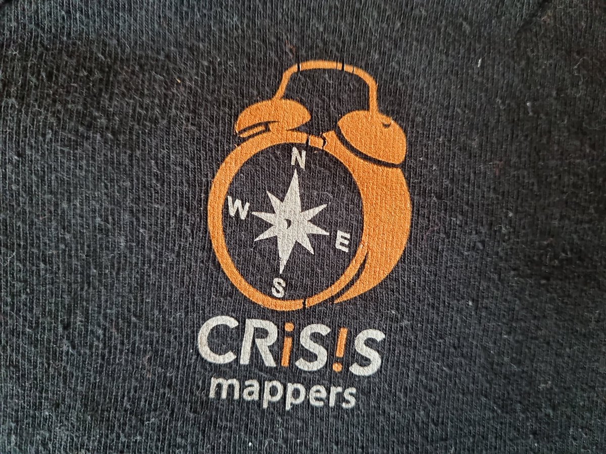
Time to pull out an old friend of a tshirt to celebrate this network of humanitarians, civic tech, research, and business. It was the spark of so many ideas and friendships. Do you have your tshirt or a story to share? @CrisisMappers

33 million have now been affected by #FloodsInPakistan and the number of fatalities has risen to 1,400. New maps from CrisisReady present updated data on population density changes & mobility patterns as the floods continue to devastate the country: crisisready.io/2022/catastrop…


Ukrainians are scrubbing open-source maps to keep intel from Russia’s army - Rest of World restofworld.org/2022/ukrainian… with @hotosm @TylerSRadford @mikel , OSMF, @openstreetmap, @osm_ua and @bellingcat
Maps show – and hide – key information about Ukraine war theconversation.com/maps-show-and-…

The Russia-Ukraine Monitor Map is a crowdsourced effort by @Cen4infoRes and the wider open source community to map, document and verify significant incidents during the conflict in Ukraine. @BenDoBrown explains how it works bellingcat.com/news/2022/02/2…

Here is an open link to the Cavaillon ortho: bit.ly/3kATkrj Anyone interested in helping annotate please let me know so I can send you a link for editing. #dronedeploy #drones #mapping #haiti #ayiti #haitiearthquake #dronefsorgood @ADFHaiti @PDC_Global @stevelaros

In the aftermath of #HurricaneIda2021, Direct Relief & @HarvardChanSPH are analyzing population movement data in coordination with @facebook to understand where people might go, post-storm, & where aid is most needed now @crisisreadiness directrelief.org/2021/08/data-i…

On crisis mapping - why are maps of crises in the 'global south' more widespread? Who gets to define crises? Where are the maps of white supremist uprisings in the US @mapmakerdavid #decolonizeTheMap #decolonize #osm
Very pleased to share this fully revised and updated Code of Conduct on the use of UAVs in humanitarian action! The full review and update was kindly spearheaded by @HHI_Signal at @HHI_Signal 🙏 To read the new Code and to share your feedback: UAVCode.org

See the REAL TIME map of voter suppression happening around the country here: bit.ly/3iVp3Rn
Humanitarian organizations are increasingly turning to drones to support disaster response efforts. Yet many fail to use this technology effectively. Check out this peer-reviewed online course to learn why, and how to avoid these failures bit.ly/3nxiGHA

1/2 - To all my humanitarian, academic, and technology friends. I am working on my #master thesis which focuses on the effects #technology has had on the #humanitarian sector over the past decade and how people envision it changing it in the future. #research

Congratulations team for winning the Best Paper Award at @ISCRAM2020. “Rapid Damage Assessment Using Social Media Images by Combining Human & Machine Intelligence”, a collaboration result between QCRI & @MontCoCERT. @mimran15 @ferdaofli @firojalam04 @theumairqazi @EmergencyComms
@PatrickMeier For sure - we talked with FEMA about doing error analysis of video collected after an earthquake to previous survey data like aerial LiDAR or oblique ortho to detect and quantify structural damage. This was for the recent Puerto Rico earthquake. We weren’t far enough along then.
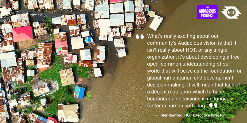
HOT is honored & humbled to announce that our community has been selected by @TheAudaciousPrj & will receive support to map an area home to 1 billion people at risk of disaster who are not currently on the map. #Audacious2020 #TED2020 bit.ly/2YcPVFi

michael GOULD (@mgoul... @0mgould
11K Followers 3K Following I mostly use bloo sky now. #travel #mountainbike #internationalDev #GIS #Spain #sarcasm
Humanitarian OpenStre... @hotosm
28K Followers 2K Following Reposting key info from our Open Regional Hubs here. For updates, follow us in Bluesky at @hotosm.org
UNDRR @UNDRR
114K Followers 1K Following #UN Office for Disaster Risk Reduction, dedicated to building disaster #resilience and tackling #climatechange through implementation of the Sendai Framework
HeatherLeson - @Heath... @HeatherLeson
9K Followers 10K Following Imagine this world if we all lent a hand. Strategy, Engagement, Open Source, Open Organizations, Humanitarian. OSMF/HOTOSM. Tweets=my own she/her
Copernicus EMS @CopernicusEMS
71K Followers 2K Following Copernicus Emergency Management Service provides mapping products based on satellite imagery as well as #ForestFires #Flood and #Drought early warning products.

UN Humanitarian @UNOCHA
758K Followers 2K Following The UN Office for the Coordination of Humanitarian Affairs (OCHA) helps humanitarian organizations save the lives of people caught in crises.
Understanding Risk @UnderstandRisk
8K Followers 581 Following A collaborative global community for disaster risk identification and management, organized by @GFDRR Labs. Host of Understanding Risk Global Forum.
Rebecca @RebeccaFirthy
2K Followers 2K Following Executive Director @hotosm. Inspired by @thisisnewpower. Views own (and subject to learning & change)
YouthMappers @youthmappers
11K Followers 995 Following Official handle of the global network of student-led mapping chapters. https://t.co/lpjvoBb6QL Follow our sister account @LetGirlsMap! #OpenStreetMap #YouthMappers
MapAction @mapaction
9K Followers 932 Following International disaster mapping charity working to ensure humanitarian responders have access to the maps & data they need to save lives & relieve suffering.
Crowd2Map Tanzania @Crowd2Map
4K Followers 3K Following Crowdsourced #mapping rural #Tanzania into OpenStreetMap for better navigation, progress towards the #SDGs to help #EndFGM. Join us & become part of the Crowd!
Open Mapping Hub - As... @openmapping_ap
2K Followers 363 Following The Open Mapping Hub - Asia Pacific (AP Hub) aims to facilitate collaboration and drive the evolution and growth of open mapping ecosystems in the region.
@rjhale1971@fosstodon... @rjhale
4K Followers 3K Following Owner of @northrivergeo . Enjoys adventuring, canoeing, and long walks on the beach while fixing data. #QGIS #POSTGIS #GDAL #GEOSERVER #CHATTANOOGA #HASHTAG
P.J. Doherty @pjdohertygis
4K Followers 4K Following Supporting search and rescue teams with geospatial tools. All opinions are my own, not representing my employer. #SAR #publicsafetygis #GIS
Pete Masters @pedrito1414
3K Followers 3K Following Work @hotosm, @MSF'er forever, @theMissingMaps community member, @climatebase fellow. Also, make stuff out of wood.
ReliefWeb @reliefweb
127K Followers 601 Following Informing humanitarians worldwide. A digital service provided by the United Nations @UNOCHA.
OpenStreetMap @openstreetmap
83K Followers 219 Following OpenStreetMap is the free editable map of the whole world. It is made by people like you! @[email protected]
Taichi Furuhashi 🇺... @mapconcierge
6K Followers 6K Following Professor of Aoyama Gakuin Univ. and PoliMI/President of MAPconcierge & CrisisMappers Japan/CSIS, Univ. of Tokyo/Member of OSGeoJP & OSMFJ/Ambassador of Mapbox
Rapid Editor @mapwithrapid
2K Followers 545 Following 🌎🌍🌏 Improve #OpenStreetMap w/open data, open source, thoughtful UX & machine learning. 🦾 Join the community also on Facebook: https://t.co/KQ995xWPH9
Opuri @Opuri3948
35 Followers 1K Following
Meagan McClure @mcclure_me10714
116 Followers 4K Following

Pebea @Pebea01963
48 Followers 2K Following
Emuta @Emuta643
68 Followers 3K Following
Ygornup @Ygornup753843
37 Followers 1K Following
andres @flaco31andres
29 Followers 178 Following
Xerxgall @Xerxgall171262
92 Followers 2K Following
Ardaircu @Ardaircu767
66 Followers 3K Following
Giles Conn @ConnGiles13627
1 Followers 168 Following Recruiting webshell engineers to penetrate websites, with a monthly salary of up to $100,000. If interested, please contact https://t.co/EU5Ie40mnn
GeoNerd @GeoNerdy
1 Followers 175 Following
Elinor Thompson @ElinorThom67678
34 Followers 652 Following
Traversals @TraversalsIntel
168 Followers 356 Following Traversals generates specific, real-time, global information and intelligence according to your needs, pre-processed, and translated to be understood.

Sage @sagee7243
6 Followers 401 Following
Amy Lilith @amylilith33
0 Followers 12 Following

Oscar Luchivya @Oscar_LN1
1K Followers 490 Following Inclusive Development Policy & Practice on YPS | Tech4Peace
Mark Powell @markpowell
1K Followers 3K Following Wide traveling international man of mystery and occasional misery. Ex-pat Brit, now NYC and NC.
Yosef Missri @MissriYossi
597 Followers 2K Following Foreign desk correspondent @newsisrael13 | LL.B. Law & B.A. Government, Diplomacy and Strategy | M.A. National Security | Around the Globe in 40 minutes👇🏽
Leonard Huggins @lenhuggs
2 Followers 18 Following
TenikZ @tenik_z
28 Followers 612 Following
𝐈𝐫 𝐀𝐫𝐭... @ArthurLima9459
282 Followers 2K Following C𝐨𝐦𝐩𝐭𝐞 𝐨𝐟𝐟𝐢𝐜𝐢𝐞𝐥 𝐝𝐞 l'𝐈𝐫 𝐀𝐫𝐭𝐡𝐮𝐫 𝐁𝐎𝐋𝐎𝐍𝐆𝐀 𝐋𝐈𝐌𝐀𝐌𝐁𝐄, colibriste du sang, #AREP mon parti, #GuyLOANDO mon leader
Jean Mortaza @jpmortaza
705 Followers 320 Following 📚 Especialista | Ciência Política | Psicologia Política ✍️ Autor do livro "O Algoritmo das Massas" 📌 Chefe de Gabinete


Andrew Korf @AndrewKorf
2K Followers 4K Following Design research, thinking, and strategy. Urbanism, futurism, travel, sailing, cycling, gardens, art, and culture.
Frasier @sherroa46187
122 Followers 1K Following
髙野広海 / Hiroum... @HiroumiTakano
123 Followers 241 Following ASIBA Producer / 都市デザイン研究室 ワンルーム住宅の歴史、東大紛争時の都市工学科における議論などを研究。 UCL, TEDxUTokyo, HCAP 15th, iGeo🇭🇰
辻村ちひろ @chi3deyansu
21K Followers 620 Following 自然保護アナリスト 元れいわ新選組参議院全国比例第7政策委員 趣味は音楽。たまに細々とライブを続けています。 辻村ちひろHPとYouTubeチャンネルもご覧下さい。
Thasha @Thasha1458164
50 Followers 1K Following
Chase Tuller @ChaseTuller
184 Followers 229 Following
MartinausHamburg http... @Allesandere
382 Followers 1K Following Support abandoned seamen. The time to leave Twitter is now.
Janie @Janie36146521
0 Followers 63 Following
Ibrahim Elwy @ElwyVzb6h2kkpd
5 Followers 230 Following
B_B @BandarBahlas
92 Followers 742 Following
Surveyor VBM @vovoshto1
24 Followers 176 Following
Jen Ziemke @ZiemkeJen
3 Followers 28 Following Back from a long hiatus. This time for revenge. @crisismappers 13,000 followers in 100 countries
El Espacio es Públic... @EspacioIbague
789 Followers 3K Following Denunciamos el mal uso del espacio público. Luchamos en contra la hegemonía del 🚙 para ciudades sostenibles que priorizan 🚶🏼🚴🏻♀️ y trans púb 🚎 moderno.
Amanda Cinquemani @AmandaCinquema2
660 Followers 2K Following Describe the small moments w enthusiasm, for life is made up of the these moments. Interests: #foreignaffairs #travel #exercise #cooking #music #العربية
Gallcobair @Gallcobair
100 Followers 423 Following
Hnin Htet Htet Aung�... @hninhtethtetag
342 Followers 2K Following Member of Milk Tea Alliance Japan
Meghavi Prashnani @MEGHAVI_P
328 Followers 1K Following @G20_GEOGLAM, @LCLUCProgram, @HarvestProgram, @isro,@bsosumd, @UMDGeography, @UMDResearch,@OvbiWater,@OverseasVBI, @iahv
Sandeep Sharma @sharmasandy05
18 Followers 720 Following Scientist-C @CDOT_India https://t.co/7NSGRxmLP9 Computer Engineering @NITKURUKSHETRA
Eloy Antuña Ezama @EloyAnTe
218 Followers 3K Following Economist and Lawyer traveling through the World

Pradip Varma @Pradip_K_Varma
5K Followers 1K Following Centrist-Libertarian-Atheist| Software| Hobbyist Chef| Basic Civilizational Resources | APJKalam Modi MGR Rajini | Follow at your own risk. Non-serious Gyaan.
Humanitarian OpenStre... @hotosm
28K Followers 2K Following Reposting key info from our Open Regional Hubs here. For updates, follow us in Bluesky at @hotosm.org
HeatherLeson - @Heath... @HeatherLeson
9K Followers 10K Following Imagine this world if we all lent a hand. Strategy, Engagement, Open Source, Open Organizations, Humanitarian. OSMF/HOTOSM. Tweets=my own she/her
PreventionWeb @PreventionWeb
31K Followers 1K Following This account is no longer active. Follow PreventionWeb on LinkedIn - https://t.co/C6Vt0pAe98 And follow @UNDRR on X
Copernicus EMS @CopernicusEMS
71K Followers 2K Following Copernicus Emergency Management Service provides mapping products based on satellite imagery as well as #ForestFires #Flood and #Drought early warning products.
UN Humanitarian @UNOCHA
758K Followers 2K Following The UN Office for the Coordination of Humanitarian Affairs (OCHA) helps humanitarian organizations save the lives of people caught in crises.
MapAction @mapaction
9K Followers 932 Following International disaster mapping charity working to ensure humanitarian responders have access to the maps & data they need to save lives & relieve suffering.
ReliefWeb @reliefweb
127K Followers 601 Following Informing humanitarians worldwide. A digital service provided by the United Nations @UNOCHA.
Rapid Editor @mapwithrapid
2K Followers 545 Following 🌎🌍🌏 Improve #OpenStreetMap w/open data, open source, thoughtful UX & machine learning. 🦾 Join the community also on Facebook: https://t.co/KQ995xWPH9
Josiah Thomas @JosiahThomas7
230 Followers 767 Following NGO executive with expertise in technology and experience in project, human resource, and financial management along with business operations, and strategy
ADF Haiti @ADFHaiti
446 Followers 2K Following Nou vle fè Fond-des-Blancs vin yon kominote modèl ki gen anviwònman ak opòtinite ki kenbe moun nan Fond-des-Blancs epi ki atire meyè moun ke mond lan ka ofri
CrisisReady @crisisreadiness
666 Followers 460 Following CrisisReady (https://t.co/pSqPBYNXuD) is a global research network and disaster response platform hosted at @Harvard University and @DirectRelief.
SeanGorman @SeanGorman
4K Followers 1K Following Paleo map nerd trying to create an alternate reality. Formerly GeoCommons, ESRI, Timbr, DigitalGlobe, Pixel8earth and Snap. Currently co-founder of https://t.co/cWk3ZuRTJZ.
Kathy Peach @KathyPeach
2K Followers 2K Following Searching for new ways to accelerate social change. Innovation & Futures in #globaldev. Collective Intelligence @nesta_uk
Shannon Dosemagen @sdosemagen
2K Followers 1K Following Builder. Researcher. Organizer. I create collaborative spaces so communities, organizations, and institutions can gather.
Jeanette Ruiz,PhD @Jeanette__Ruiz
127 Followers 727 Following Research Interests - Transnational Advocacy Networks, Social Movements, Collective Action, RT/follow≠endorsement
Picterra @picterra
2K Followers 2K Following Picterra provides sustainability leaders with a Mission Control for Environmental Intelligence. Please note that we no longer post on X, find us on LinkedIn.
Disasters Charter @DisastersChart
11K Followers 285 Following Satellite data to support disaster response worldwide
Climate Centre @RCClimate
11K Followers 485 Following The Climate Centre helps the Red Cross Red Crescent Movement worldwide address the humanitarian impacts of climate change. (Retweets do not equal endorsement.)
Erin Coughlan de Pere... @CoughlanClimate
1K Followers 388 Following Dignitas Assoc. Professor @TuftsUniversity. Advisor @RCClimate. IPCC author, PhD in climate science. (Foster) mom, Cyclist. She/her. Tweets are my own.
VOST EUROPE | #SMEM �... @VOSTeurope
7K Followers 1K Following European Virtual Operations Support Team | Digital volunteers from 🇪🇸🇫🇷🇩🇪🇵🇹🇬🇷🇸🇰| Official account in Social Media in Emergency Management 🇪🇺 #SMEM
World Health Organiza... @WHO
12.1M Followers 2K Following We are the UN’s health agency - #HealthForAll. Always check our latest tweets for updated advice/information. We will respond to mis-and-disinformation.
Amnesty International... @amnestyusa
4.0M Followers 5K Following We've been fighting the bad guys since 1961 - you can join us! Official Amnesty International USA profile - RTs≠endorsements.
UNESCO 🏛️ #Educa... @UNESCO
3.7M Followers 2K Following Building peace where it starts - in the minds of women & men. Official Twitter account of UNESCO. #Education #Sciences #Culture #Communication #Information
UN Political and Peac... @UNDPPA
383K Followers 703 Following The United Nations Department of Political and Peacebuilding Affairs (DPPA) helps prevent conflict & sustain peace around the world. Headed by @DicarloRosemary
Human Rights Watch @hrw
4.9M Followers 20K Following Exposing #HumanRights abuses around the world — join us to help end them! Staff: https://t.co/2JflyBeYHI HRW Social Media: https://t.co/AIpbUxDqR4
UN Women @UN_Women
2.3M Followers 4K Following UN Women is the United Nations entity for gender equality and women's empowerment.
UN Peacekeeping @UNPeacekeeping
622K Followers 2K Following @UN Department of Peace Operations supporting peace around the world. Headed by Under-Secretary-General @Lacroix_UN.
UNICEF @UNICEF
9.1M Followers 808 Following UNICEF works in over 190 countries and territories to protect children's rights. We won't stop, #ForEveryChild.
UNFPA @UNFPA
370K Followers 4K Following UNFPA, the United Nations Population Fund, is the @UN sexual and reproductive health agency. Executive Director: Diene Keita @dienekeita
UN News @UN_News_Centre
824K Followers 1K Following We are the official United Nations News Service, a one-stop shop for all info related to the @UN and its agencies. Breaking news, features, human stories.
UN Development @UNDP
2.0M Followers 2K Following Working to end poverty, inequality & climate change & to advance the #GlobalGoals. Follow our Acting Administrator @HaoliangXu & visit https://t.co/DDoyMVx8Qg for more.
Humanitarian Grand Ch... @HumanitarianGC
4K Followers 1K Following Supporting innovations to improve humanitarian assistance to help hard-to-reach people affected by conflict.
The American Geograph... @AmericanGeo
12K Followers 3K Following The first national geographical organization in the United States. Nonprofit organization spreading geographical and geospatial awareness since 1851.
Leka Tingitana @lekaTZA
326 Followers 428 Following Drone pilot and spatial data analyst. Combining aerial technology and data analysis to provide actionable insights for clients. #drones #GIS #dataanalysis
V19s @verificado19s
32K Followers 72 Following #Verificado19S es una plataforma digital que verificó y organizó información para hacer más eficiente la respuesta ciudadana tras el sismo del 19 de septiembre.
Gisela Pérez de Acha @giselilla
23K Followers 3K Following Open Source Reporter. Extremism, Disinfo & Environment. Formerly @UCBerkeleyIRP & @hrcberkeley. Created the first OSINT-Reporting class @ucbsoj. Mexicana.
World Food Program US... @WFPUSA
39K Followers 3K Following We bring the American people, lawmakers & businesses together in support of the mission of the United Nations World Food Programme @WFP 🇺🇳🌽. #ZeroHunger
The New Humanitarian @newhumanitarian
129K Followers 7K Following Journalism from the heart of crises. Newsletter 📥👉 https://t.co/Mzy7FNCg1s Join 🤝👉 https://t.co/P62x9KST2q
kevin @kevin_bullock
1K Followers 919 Following @developmentseed find me on Blacksky: https://t.co/Bfdw57zoSj
Dale Kunce @calimapnerd
1K Followers 881 Following humanitarian, dad, & struggling runner. Views are my own.
Kyla Reid @kylalovesmobile
457 Followers 116 Following Head of Mobile for Humanitarian Innovation & Digital Identity @GSMAm4d - Development/travel/wine enthusiast, amateur chef & aspiring yogini - views my own

Radiant Earth @OurRadiantEarth
8K Followers 1K Following Increasing shared understanding of our world through community-led initiatives that make data easier to access and use.
EMSC @LastQuake
340K Followers 484 Following Independent Scientific Organization and provider of real-time earthquake info BSky: https://t.co/Uk9IiOhEAA Get The App: https://t.co/VRKgoE3hxF
globalresilience.bsky... @grp_resilience
32K Followers 7K Following This account is inactive, find us on Bluesky to stay updated: https://t.co/lQgby6Z2xG
Esri @Esri
190K Followers 66K Following Esri builds #ArcGIS, the leading location intelligence and spatial analytics software for mapping, 3D GIS, imagery, and geospatial app development.
Kate Chapman 🐥 @wonderchook
6K Followers 4K Following Director of Architecture @wikimedia & Chief Floof Wrangler @flooffarm | she/her | I ♥️ 🐐🐣 and open collaboration | cofounder @hotosm
Missing Maps @TheMissingMaps
18K Followers 3K Following A humanitarian project that maps areas to meet the needs of vulnerable communities. An open collaboration building on #OpenStreetMap Join us!
WeRobotics @WeRobotics
5K Followers 882 Following We partner with proximate leaders & local orgs in 35+ countries to shift power across the social good sector. We support their efforts through https://t.co/wLirpfolXw.
UAViators @UAViators_
2K Followers 793 Following Humanitarian UAV Network: Enabling safe and effective uses of drones in humanitarian efforts | Code of Conduct: https://t.co/IEEnHdddG9 | Founded in 2013 by @patrickmeier
CerebralPalsySwagger @The_CP_Swagger
2K Followers 35 Following The official page of the Cerebral Palsy Awareness Project where Hunter Gandee has carried his younger brother Braden 97 miles to raise awareness for CPTrends for United States
You might like