Joseph Elfelt https://m.ai6yr.org/@mappingsupport @MappingSupport
My new content is on Mastodon at https://t.co/lU28X2nWBy Software project page https://t.co/x7r8jsQOSH mappingsupport.com Redmond, WA Joined November 2015-
Tweets8K
-
Followers3K
-
Following247
-
Likes5K
Key messages concerning today's (1/21) extremely critical fire weather in southern California.

I posted an interactive map for the #MountainFire in Ventura County that shows the latest fire perimeter, parcel lines and house numbers. But that map link is not here. Instead it is on my Mastodon feed at m.ai6yr.org/@mappingsupport
I just posted an interactive GIS map that displays high resolution aerial photos just taken by NOAA of #Florida areas maybe affect by #Milton. The map also shows clickable parcels and house numbers. Map link is on my Mastodon feed at m.ai6yr.org/@mappingsupport
I just posted an interactive GIS map for the #ElkFire west of #Sheridan Wyoming. Sorry to say, there was massive growth last night. You can find that map on my Mastodon feed at m.ai6yr.org/@mappingsupport
Civil Air Patrol has taken a ton of low level photos showing damage from #Helene in #Asheville and the rest of western NC. I made a GISsurfer map anyone can use to view those pics. The map link is on my Mastodon feed at m.ai6yr.org/@mappingsupport
I made an interactive GISsurfer map that displays aerial photos from NOAA showing damage from #Helene in FL. The map opens at Keaton Beach where *many* homes are 100% gone. You can find that map on my Mastodon feed at m.ai6yr.org/@mappingsupport
I have been posting GISsurfer maps for #HurricaneHelene . They are on my Mastodon feed at m.ai6yr.org/@mappingsupport
I just posted an interactive GIS map for the #LineFire. But you will not find that map here. Instead, it is on my Mastodon feed at m.ai6yr.org/@mappingsupport
For anyone trying to display a GISsurfer map, my server is currently offline. This is *very* painful since it is my own dumb fault. Waiting on specialist tech support at my ISP.
I am posting interactive GIS maps for the #BasinFire but you will not see them here. They are on my mastodon feed at m.ai6yr.org/@MappingSupport
I just posted an interactive map with the latest FIRIS perimeter for the #PostFire plus satellite hotspot data. But you will not see that map here. Instead, it is on my mastodon feed at m.ai6yr.org/@mappingsupport
Very early this morning there was an infrared flight over the #Blue2Fire in New Mexico. I posted an interactive map showing that data on my Mastodon feed at m.ai6yr.org/@mappingsupport
I am posting GISsurfer maps for the #ParkerLakeFire in British Columbia. But you will not see those maps here. Instead, they are on my Mastodon feed at m.ai6yr.org/@MappingSupport #Wildfire #BCfire #BCwildfire #BCwx #FortNelson
Apps like OnX, LandGlide, Regrid, etc, display a *copy* of the county's parcel data. If the county data is bad then these apps display the same bad data. For a comparison showing a custom property map I made and bad county data see my mastodon feed. m.ai6yr.org/@mappingsupport
I posted an interactive map with the #eclipse track and a GIS overlay that displays links to NOAA's forecast discussion for each forecast zone along the eclipse path. That map link is on my mastodon feed at m.ai6yr.org/@MappingSupport #eclipseSolar #eclipse2024
I made an interactive map showing the tax parcels that are assessed to Seven Springs LLC. This is the Trump family compound on which the New York AG has placed liens. The map link is posted on my Mastodon feed at m.ai6yr.org/@MappingSupport #SevenSprings #SevenSpringsLLC
The GeoJPG web app (version 2) is ready for use. You can make your own custom #maps and view them offline with NO ads, NO tracking, NO signup and NO fees. For more information and a link to the web app see my mastodon feed at m.ai6yr.org/@mappingsupport #OfflineMaps #Mapping #Hiking
I just posted a series of screenshots for #GeoJPG v2 - release data March 19. Make your own custom high quality offline maps for iOS and Android with NO ads, NO tracking, No signup and NO cost. Those screenshots are on my Mastodon feed at m.ai6yr.org/@mappingsupport
I just posted an interactive GISsurfer map showing dams in the greater LA area with a condition rated as either "poor" or "unsatisfactory". The map also shows a running forecast for the next 7 days of rain. A link to that map is on my Mastodon feed at m.ai6yr.org/@mappingsupport

Holy crap. The Lincoln Project just released an amazing new ad going after Donald Trump for being a dictator and abusing power. This is one of the best political ads I’ve ever seen. Definitely worth a watch.

Dr. Daniel Swain @Weather_West
103K Followers 3K Following Climate scientist-communicator focused on extreme events like floods, droughts, & wildfires on a warming planet.
Cascadia Fire Has No ... @barkflight
18K Followers 12K Following Staff reporter, @watchdutyapp. @mediaatillinois grad student in science journalism. Focused on wildfire. Incident tweets unofficial + not emergency advice.
Rob Mayeda @RobMayeda
33K Followers 10K Following NBC Bay Area since 2003, AMS #1682, SJSU Meteorology Lecturer. Formerly KIRO, KCRA, KSBY, KESQ, KNBC, Arizona Daily Wildcat & Father of twinados 👦🏻🌪️👦🏻🌪️
VCscanner @VCscanner
89K Followers 665 Following Tweeting breaking news from across Ventura County, CA as it happens. **All tweets are unofficial** PayPal: https://t.co/0AVgPM0goo Venmo: @vcscanner
CA Fire Scanner @CAFireScanner
121K Followers 944 Following Kiwi tweeting info on California fires. Tweets not official & should not be treated as such. I work for @watchdutyapp. 🇳🇿 Download WD: https://t.co/VCJybwf642
CaliforniaDisasters @CalDisasters
6K Followers 1K Following On https://t.co/SmHH56qgbx WX/Geo/Fire/Disaster/History Buff/CERT/Rockhound.
Stacey @stacey_hb_
2K Followers 769 Following Emergency Management, SAR, Missing Children Advocate, DSW Equine Evac Lead Working in one way or another on fires and floods since 2008
🥔🗺️ ᴘᴏᴋ... @pokateo_maps
28K Followers 3K Following po-KATE-o, first of her name, eater of potatoes 🥔 and maker of maps 🗺️. I make GIS (more) fun by sharing maptastic themes & original mappy memes! 🌐 ᵛᶦᵉʷˢᵐᶦⁿᵉ
Tay Austin @Jasamsdestiny
2K Followers 115 Following Disaster Assist Volunteer I do my best to keep you safe & informed

John Hawkins @JhawkFire
8K Followers 8K Following Wildland Fire Consultant - Fire Chief (ret) Formr CALFIRE/RivCo Fire Chief 12yrs - 55yrs FireServ LoveFF's & Serv'nPublic TransformationalServantLdr
John Fisher @JohnAFisher
3K Followers 3K Following Retired Battalion Chief for a SoCal metro. PSC1/FBAN. Two hundred years of tradition enhanced by progress. Student of fire. More or less in line. Nov 2008.
Alec_wx @Alec_wx
643 Followers 877 Following 20 years old| Bay Area native|| @uw atmospheric science nerd| drone photography| storm chasing
Philip G Desmet @snorstadsurfer
110 Followers 413 Following A constant gardener. Conservationists. I speak for the trees. Own financial adviser. Generally contrarian. I do not tollerate umm.
Peter Gleichner @GleichnerP40565
113 Followers 4K Following
Andrew @scalepilledpooh
180 Followers 904 Following high-taste scale-pilled policy-loving believer. Hear my takes on the Superintelligence Policy Podcast: @superpolicypod
Edna Wisozk @EdnaW20323
69 Followers 3K Following
Quju @Quju6206
19 Followers 2K Following

سـعيدة الصـ... @saida_alsaleh
10K Followers 5K Following ﴿ ضَـاحِكَةٌ مُســتَبشِـره ﴾ #عام_الاكتمال_2025
Phil Drexler @phil_drexler
64 Followers 661 Following
Ookoowo @Ookoowo2703
31 Followers 1K Following
Lauscau @LauscauT9lP
17 Followers 1K Following
Jordan Sallaska @jordan_sallaska
0 Followers 7 Following
🌐David C. Stearns ... @DavidCStearns
477 Followers 4K Following Geographer, Geo-Spatial Professional, Tech Innovator, Amateur Meteorologist, Photographer, Amateur Radio, SWL, Geo-Politics, Jayhawk 4 life, Opinions = My own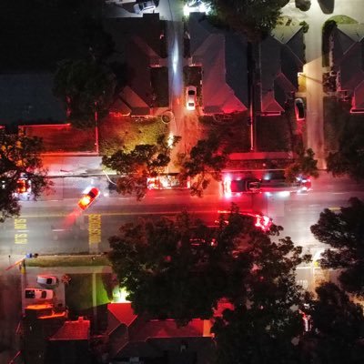
Local_Informant01 @LInformant01
2K Followers 274 Following Photo Journalist. Providing you with a Perspective to local issues and incidents in the I.E and Riverside county. Subscribe to my YouTube
Mamadou @Mamadou12064478
441 Followers 7K Following Love humanity only love can set up us free from evil ❤️ and I love God 🙏

CARE @3xdaily
396 Followers 6K Following Think preventative. Healthcare starts in home.🇺🇸💪FA-FO!💪🇺🇸 🇺🇸🚁
wildfiressb @wildfiressb
5 Followers 10 Following WildfireSSB is TinySSB tailored for wildfire management and communication. It's a decentralized, offline-first protocol that enables se
Boys & Girls Clubs of... @GreatFutures
765 Followers 1K Following A quality after-school youth program serving families throughout Napa & American Canyon since 1956 𝘎𝘙𝘌𝘈𝘛𝘌𝘙 𝘍𝘜𝘛𝘜𝘙𝘌𝘚 𝘚𝘛𝘈𝘙𝘛 𝙃𝙀𝙍𝙀.

Loughl @Loughl6jgEkzD
22 Followers 972 Following
reserved @reserved959880
42 Followers 4K Following
Michael McIntyre @taulenough
1K Followers 5K Following Farmer 🍊🍋🥝🥑🍇 🐓🐑🐂🐎Enjoying the time with my beautiful Wife, Caring for My Mom Missing My Father. American Party 1st
Torsmesl @Torsmesldi0J1
28 Followers 841 Following
Kare L @KareL71871876
46 Followers 397 Following
andrew engler @aerockrose
689 Followers 567 Following 3x founder, CEO https://t.co/TDxnDsbqvl. Built 3 $100M insurtech businesses. I dream of insurance, ml, and self organizing criticality.
Sea⚡Kelpie @S3a_Kelpie
524 Followers 1K Following Guardian of the Ancestral Aunties Cosmic Revolution |Half Blind Heathen Wench|Music| Arcana|Gutter Rhymes|Kitchen Prose| Haiku|Shiny Rocks & Shells 🌊⚡💚
Jenny Janecka @jennysoljan
0 Followers 18 Following
clara Anabel @chivycha
91 Followers 2K Following Annal ,FaceTime and my sexy squirt dropbox available 😘 text my WhatsApp only for menu

Sabrina Belleci @SabrinaTahoe
0 Followers 47 Following
Jason McGraw @jmac1223
158 Followers 781 Following Baseball. Golf. Fly Fishing. Hunting. SF Giants. University of Nevada alumni
TheDriver @TheDriver_69
0 Followers 832 Following

Jason Toups @jasonptoups
197 Followers 692 Following
MTN HIKR @MNT_HIKR
25 Followers 177 Following
Geoff Millikan @gmillikan
765 Followers 857 Following Occasional local weather and natural disasters otherwise #payments #bigdata #FinTech | 4 sons | Opinions expressed here are my own.
Setewzeighth @SetewzeighthbB
25 Followers 3K Following
RE:fuse @REfuse1088938
63 Followers 4K Following
Kerri Macdonald @punkster4545
0 Followers 5 Following
johnstruk @johnstruk
14 Followers 150 Following
CAS Group @thecasgrp
17 Followers 253 Following We offer Fractional CFO advisory and accounting services, forecasts and projections, financial modeling, compliance, risk mitigation, and tax strategy.
Linda Kear-Preston @KearLinda
0 Followers 26 Following
Newthread pas @Newthread2800
13 Followers 235 Following
Cheng Wang @cwang20166
0 Followers 3 Following
Fawn @Mablepies
5 Followers 293 Following
BRENDA HINES @strgzr1992
0 Followers 3 Following
Nick Rutherford @rutherford46081
5 Followers 20 Following
Lisa Tech Nerd 🟧 @Travelingonenm
360 Followers 695 Following I love to read, travel, spend time with my family and to stand up for what is right. Senior Swiftie
Zach Stanford @zachstanford
2K Followers 4K Following Emergency Management & Homeland Security | Risk & Hazard Comms + Maps | Cares too much about emergency alerts | Opinions are mine | ENTP | WX5OEM | #EMGTwitter
Dr. Daniel Swain @Weather_West
103K Followers 3K Following Climate scientist-communicator focused on extreme events like floods, droughts, & wildfires on a warming planet.
Colin McCarthy @US_Stormwatch
146K Followers 225 Following Tracking Extreme Weather, Natural Disasters and Climate Worldwide, @ucdavisCAES, Storm Chaser.
Zeke Lunder ~ The Loo... @wildland_zko
29K Followers 279 Following Wildland Fire and Forestry Communicator. Working in the woods since 1990. Qualified Ca. Burn Boss. Intel = public data. Photos by me. Fire is the best teacher.
NWS Sacramento @NWSSacramento
98K Followers 447 Following Official X account for the National Weather Service Sacramento. Details: https://t.co/prHgbNzFn4
USGS Volcanoes🌋 @USGSVolcanoes
163K Followers 95 Following Delivering official updates and info for U.S. volcanoes. https://t.co/eugs1G0ISb email: [email protected]
VCscanner @VCscanner
89K Followers 665 Following Tweeting breaking news from across Ventura County, CA as it happens. **All tweets are unofficial** PayPal: https://t.co/0AVgPM0goo Venmo: @vcscanner
NWS Seattle @NWSSeattle
214K Followers 434 Following Official Twitter account for the National Weather Service Seattle. Details: https://t.co/yoQbjVwBSK
Watch Duty @watchdutyapp
31K Followers 220 Following Watch Duty, a 501(c)(3) nonprofit, alerts you of nearby wildfires and firefighting efforts in real-time.
CA Fire Scanner @CAFireScanner
121K Followers 944 Following Kiwi tweeting info on California fires. Tweets not official & should not be treated as such. I work for @watchdutyapp. 🇳🇿 Download WD: https://t.co/VCJybwf642
Neil Lareau @nplareau
7K Followers 322 Following Prof. of Atmos Sci. @unevadareno. Mountain WX, Wildfire Plumes, Backcountry Skiing, Frontcountry Dadding. Formerly:@SJSUmeteorology @UUtah @Livermore_Lab @MWObs
Stacey @stacey_hb_
2K Followers 769 Following Emergency Management, SAR, Missing Children Advocate, DSW Equine Evac Lead Working in one way or another on fires and floods since 2008
Cal OES FIRIS @FIRIS
21K Followers 19 Following Fire Integrated Real-Time Intelligence System: An all-hazard Cal OES mutual aid asset utilizing cutting-edge sensors to provide information for public safety
National Interagency ... @NIFC_Fire
21K Followers 2K Following The National Interagency Fire Center, or NIFC, is located in Boise, Idaho and is the nation's support center for wildland firefighting.
Michael Snyder @SeattleWXGuy
23K Followers 91 Following Host of Pacific Northwest Weather Watch, California Weather Watch on YouTube
Tay Austin @Jasamsdestiny
2K Followers 115 Following Disaster Assist Volunteer I do my best to keep you safe & informed
USGS @USGS
777K Followers 93 Following Science is only a tweet away. Tweets do not = endorsement: https://t.co/VoRuucTNuK
UW-Madison CIMSS @UWCIMSS
27K Followers 314 Following NOAA's Cooperative Institute for Meteorological Satellite Studies (since 1980) at the University of Wisconsin-Madison, the birthplace of satellite meteorology.
New Jersey Forest Fir... @njdepforestfire
17K Followers 21 Following The official Twitter account for the @NewJerseyDEP's Forest Fire Service.
Scottish Wildfire For... @ForumScottish
422 Followers 59 Following The Scottish Wildfire Forum is a multi-agency partnership who are working to prevent wildfires and limit the negative impact they have on the Scottish landscape
Scottish Fire and Res... @fire_scot
39K Followers 2K Following Never use social media to report an emergency, always dial 999. DMs not always monitored.
NOTUS @NOTUSreports
13K Followers 85 Following News of the United States. Get our free, daily newsletter: https://t.co/GDcvw0mJq9
Zach Stanford @zachstanford
2K Followers 4K Following Emergency Management & Homeland Security | Risk & Hazard Comms + Maps | Cares too much about emergency alerts | Opinions are mine | ENTP | WX5OEM | #EMGTwitter
Overture Maps Foundat... @OvertureMaps
3K Followers 43 Following Collaborative effort to develop interoperable open map data for mapping services worldwide | @linuxfoundation open source project
State of the Map US @sotmus
5K Followers 2K Following Thanks to everyone who joined us in Salt Lake City in 2024. Get ready for SotM US 2025 in Boston, June 19 - 21.
Anna Bower @AnnaBower
89K Followers 5K Following Senior Editor @lawfare. Email: [email protected] Signal username: annabower.24
Los Angeles District ... @LADistrictUSACE
7K Followers 3K Following Official Twitter of the Los Angeles District USACE. We tweet news about how we're Building Strong in AZ, CA, NM and NV. More @ https://t.co/hOGoeBjVSG
City of Pico Rivera O... @PicoRiveraCity
3K Followers 51 Following Welcome to the OFFICIAL twitter page for the City of Pico Rivera. This page is managed by the City's Media and Communications Division.
Danielle Langlois @DanielleLangWa
8K Followers 7K Following Thrilling, smart stories with heart: tribalism, corruption, the unexplained. Call your elected reps! #RankedChoiceVoting 🇺🇸 #DaniellesSocialMediaDisclaimer
Free Speech For Peopl... @FSFP
21K Followers 7K Following Reclaiming our democracy, challenging big money in politics and fighting for free and fair elections.
Lisa Rubin @lawofruby
251K Followers 2K Following @msnbc legal correspondent & recovering litigator; former: off-air legal analyst @maddow, @wagnertonight. Don’t let the pearls fool ya.
Roger Parloff @rparloff
51K Followers 1K Following Senior editor, Lawfare. Journalist. Ex-Fortune staff. Published in ProPublica, NYT, New York, New Yorker, Yahoo Finance, Air Mail, etc. rparloff on BlueSky.
Organic Maps: Explore... @OrganicMapsApp
4K Followers 3 Following Navigate with Privacy - no location tracking and no data collection. Search, routing and navigation without a cell phone signal. Community-driven & open-source.
Felt @felt
11K Followers 140 Following A better way to work with maps. @Bluesky: https://t.co/TJfGQsZH6l
Bluesky @bluesky
431K Followers 1 Following 🌐💬💙 From platforms to protocols. Bugs, feature requests, feedback: [email protected]
U.S. Naval Research L... @USNRL
32K Followers 2K Following Official U.S. Naval Research Laboratory (USNRL) account. The corporate research laboratory for the U.S. Navy and Marine Corps. RT/follows/likes ≠ endorsement.
CAL FIRE Tulare Unit @CALFIRE_TUU
5K Followers 98 Following CAL FIRE, The Department of Forestry and Fire Protection serves and safeguards the people and protects the property and resources of California.
NWS Storm Prediction ... @NWSSPC
523K Followers 163 Following Official Twitter account for the National Weather Service Storm Prediction Center. Details: https://t.co/mRyGMdRYT3

Taylor Trogdon @TTrogdon
16K Followers 2K Following Deputy Associate Director/Forecast Operations Specialist/CIRA/@noaagsl, @Mizzou/@gocreighton grad. Working in the space between research and operations.
Bureau of Land Manage... @BLMFire
27K Followers 2K Following BLM Fire prioritizes firefighter & public safety while protecting natural landscapes, wildlife habitat, & recreation areas.
Twister Kid @TwisterKidMedia
5K Followers 2K Following A Lyons. SPC fcstr. Opinions are my own. https://t.co/0wxuEYdkPs https://t.co/HKIZQfBKBl
National Institute of... @NIST
90K Followers 473 Following NIST promotes U.S. innovation & competitiveness by advancing measurement science, standards & tech to enhance economic security & improve our quality of life.
Christopher Flavelle @cflav
18K Followers 2K Following I cover the federal government for The New York Times. Views my own.
Erika Kullberg @ErikaKullberg
88K Followers 32 Following ▪️Lawyer | Host of "Erika Taught Me" podcast | 21 million followers on social | Forbes Top 50 Creator👇🏼FREE stuff🔥

Data.gov @usdatagov
29K Followers 312 Following The central clearinghouse of the U.S. Government’s open data.
PoliticsGirl @IAmPoliticsGirl
618K Followers 2K Following Believer in truth, facts & the American experiment. Follow me elsewhere! (2M+ followers across platforms)
Jose Pagliery @Jose_Pagliery
57K Followers 4K Following @NOTUSreports ⚖️ justice reporter ⚔ https://t.co/SAVQPTb1X6
TAK @ProductCtr
668 Followers 5 Following TAK is a suite of US Government owned georeferenced imagery & communications tools that allow for scaled operational planning, data sharing & target management.
Colorado Center of Ex... @cofiretech
41 Followers 9 Following We drive technological advancements to improve firefighting practices and influence innovation across the public safety community.
Ryan Crownholm @RyanCrownholm
869 Followers 263 Following Entrepreneur, Mentor, Investor, Author, Speaker, and U.S. Army Vet. President and Founder of Crown Capital Adventures Inc., @DirtMatch, and @Mysiteplan
The TAK Syndicate @thetaksyndicate
29 Followers 7 Following
Andrew Skurka @andrewskurka
9K Followers 500 Following Adventurer, speaker, guide and author of The Ultimate Hiker's Gear GuideJohn Soares - Guidebo... @TheJohnSoares
9K Followers 5K Following Northern California hiking books. I also help writers make more money in less time: https://t.co/dlYcxPI0I0. Avid hiker. Nature watcher. Thinker.
Northwest Interagency... @NWCCInfo
12K Followers 889 Following The Northwest Coordination Center (NWCC) coordinates #wildfire and all risk incidents for 11 agencies in #Oregon and #Washington.
Oka-Wen NF @OkaWenNF
5K Followers 41 Following Official Twitter for the Okanogan-Wenatchee National Forest
Mt. Baker-Snoqualmie ... @MtBakerSnoNF
7K Followers 356 Following Official tweets from the Mt. Baker-Snoqualmie National Forest. The Puget Sound's playground!
Forest Service NW @ForestServiceNW
98K Followers 1K Following Pacific Northwest Region of the Forest Service has some of the most breathtakingly beautiful areas on Earth ranging from grasslands to lush forests & beaches.
King County Executive @kcexec
24K Followers 1K Following Official Twitter account of the King County Executive. This account is no longer actively monitored. Stay in touch: https://t.co/FI4A2bPSr1.
NASAEarthdata @NASAEarthData
40K Followers 382 Following This account is inactive. Follow @NASAEarth and subscribe to our newsletter for data releases and other Earthdata news: https://t.co/pOtbqt9QpY
Linda Stevens 🌎 @Linda__Stevens
10K Followers 7K Following 🇺🇸| Advisor | Technologist | CMO | 🌎 Geographer | Geospatial | GIS | Earth AdvocateTrends for United States
You might like