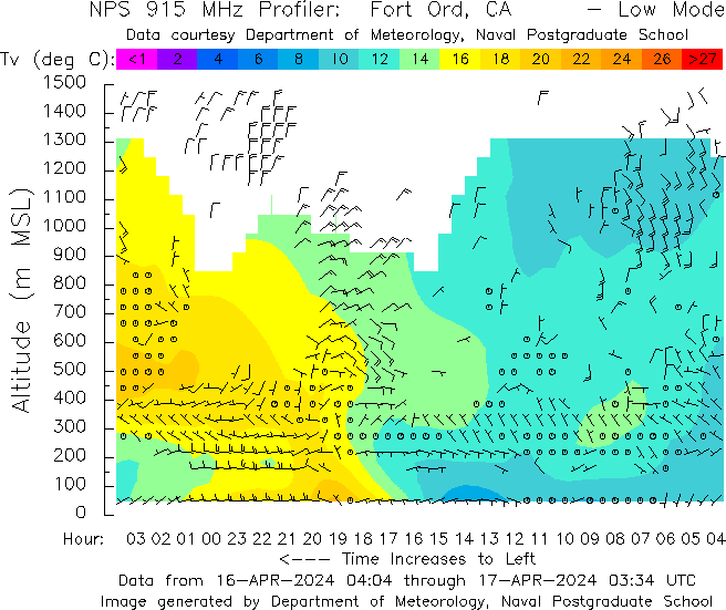
Vertical temperature and wind profiler data (latest data on left) from Bodega Bay & Fort Ord. Hardly any stratus and fog so far tonight, if either or both develop tonight it'll be compressed near sea level since the marine layer depth varies from a few hundred to 1,000 ft. #CAwx

2
3
19
12K
3
Download Image

@NWSBayArea Coastal outlines overlaid on the vector maps would be helpful.

@NWSBayArea Is there a good basic explainer on how to interpret the fog profiler data?