
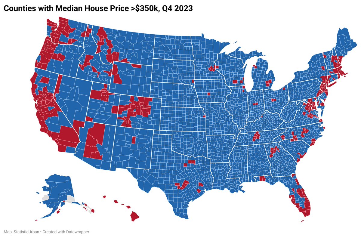

@StatisticUrban Is there a good unit below county to use? Big land area counties (San Bernadino for example) skew the visual.
@JPAdotcom Zip code is possible but there are 41,683 of them, it's a nightmare both visually and labour wise.

@StatisticUrban @JPAdotcom Do you know where the data for zip codes are? I could absolutely make that map! I might* be able to make it interactive too
@_fat_ugly_rat_ @JPAdotcom zillow.com/research/data/ They also have by neighborhood and metro.
@StatisticUrban @JPAdotcom Here's what I quickly came up with (I will go back and tweak it and make it nice with a legend and insets and whatnot)

@_fat_ugly_rat_ @JPAdotcom Nice! You're much faster than me. What program/software do you use?
@StatisticUrban @JPAdotcom QGIS! Its only a matter of joining the data with the shapefile which QGIS does automatically when you give it fields to join.
@_fat_ugly_rat_ @JPAdotcom I should learn that. I only started making maps a few months ago. My job/expertise is mostly graphs and code on SQL, Python, and R.
@StatisticUrban @JPAdotcom QGIS can be a bit hard to learn at first bur once you get the hang of it its awesome. Also your maps are pretty great for just starting out!
@StatisticUrban @JPAdotcom Here's the final product, ill probbaly post about it tomorrow with a March 2023->March 2024 change map as well.
