
Hansa Luftbild AG - Global Geo Information @hansaluftbild
Transforming Geo Information into Solutions. Worldwide since 1923. Impressum/Datenschutz: https://t.co/vvm59hxy59 hansaluftbild.de Münster, Germany Joined May 2015-
Tweets180
-
Followers72
-
Following28
-
Likes47
Arbeiten im wunderschönen Münster. Wir suchen eine(n) System- und Netzwerkadministrator (m/w/d) ... / Working in beautiful Münster. We are looking for a System and Network Administrator (m/f/d) ... #hansaluftbild #systemadministrator #netzwerkadministrator #fachinformatiker

Landschaft am Niederrhein. / Landscape in the Lower Rhine region. #hansaluftbild #niederrhein #landschaft #aerialsurveys #infrastructure #lidar #globalgeosolutions #photogrammetry #analyse #geosolutionconsulting #pilots #aeroplanes #geomarketing #mapping #software #jobs

Flug über Düsseldorf. / Flight over Düsseldorf. #hansaluftbild #duesseldorf #aerialsurveys #infrastructure #lidar #globalgeosolutions #photogrammetry #analyse #geosolutionconsulting #pilots #aeroplanes #geomarketing #mapping #software #bildflug #3d #jobs #projects #it

The Garzweiler opencast mine in the northern Rhenish lignite mining area seen from the air viewed from the air. #hansaluftbild #garzweiler #tagebau #braunkohle #rheinischebraunkohlerevier #lidar #globalgeosolutions #photogrammetry #aerialsurveys #jobsingermany #geosolutions


Flug über Niederaußem mit Sicht auf das Kraftwerk. / Flight over Niederaussem with a view of the power station. #hansaluftbild #niederaußem #kraftwerk #lidar #globalgeosolutions #photogrammetry #aerialsurveys #geosolutionconsulting #pilots #aeroplanes #geomarketing


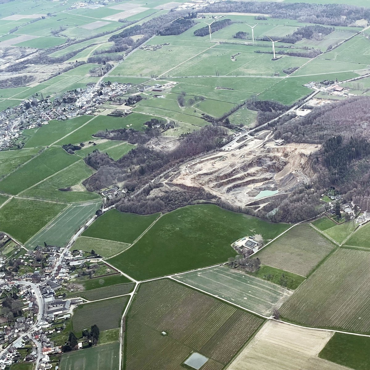
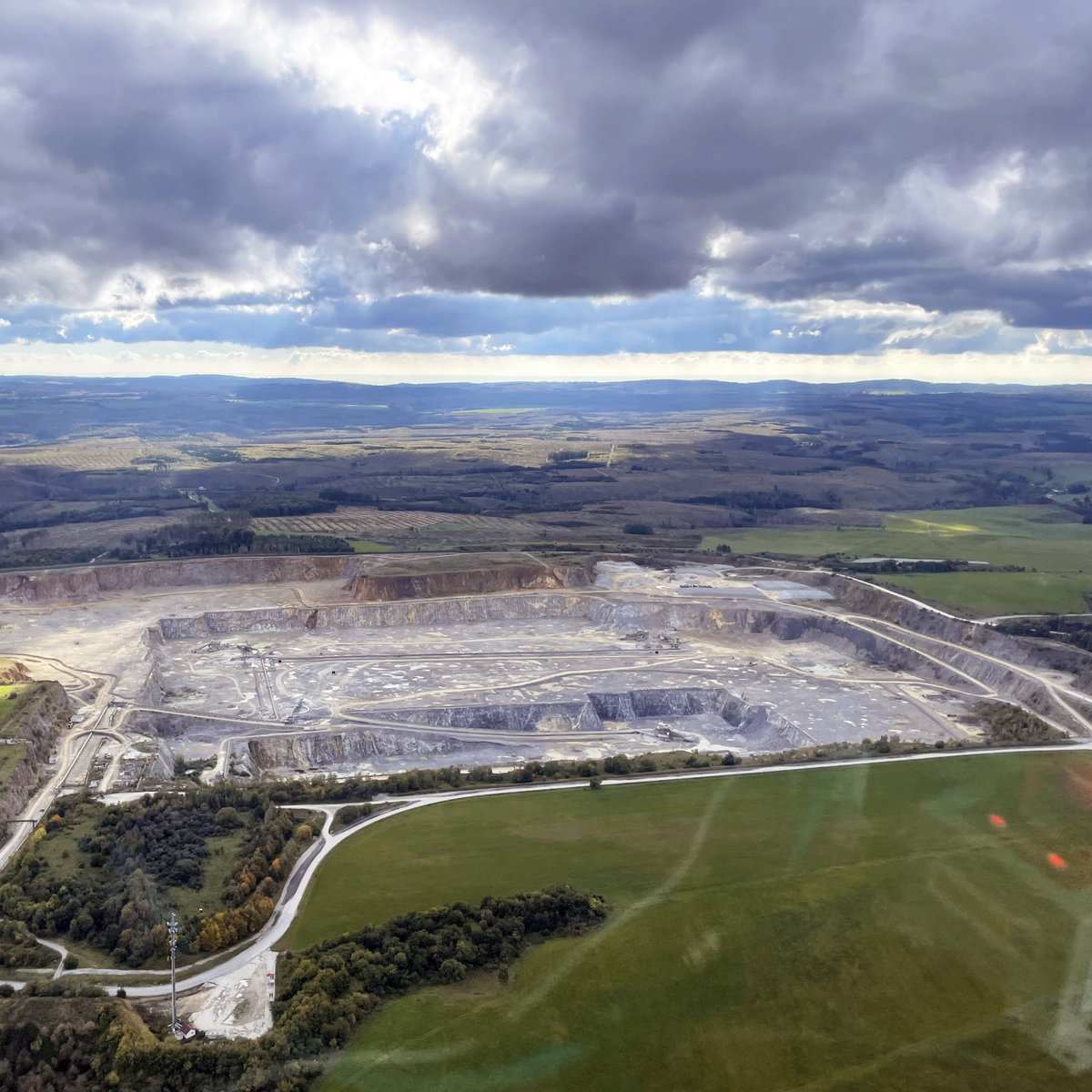
Aachen und der dortige Steinbruch aus der Luft betrachtet. / Aachen and the local quarry viewed from the air. #hansaluftbild #aachen #steinruch #aerialsurveys #infrastructure #lidar #globalgeosolutions #photogrammetry #analyse #geosolutionconsulting #geomarketing #mapping


Flug über die Innenstadt von Bochum. / Flight over the city center of Bochum. #hansaluftbild #bochum #aerialsurveys #infrastructure #lidar #globalgeosolutions #photogrammetry #analyse #geosolutionconsulting #pilots #aeroplanes #geomarketing #mapping #software #bildflug #3d


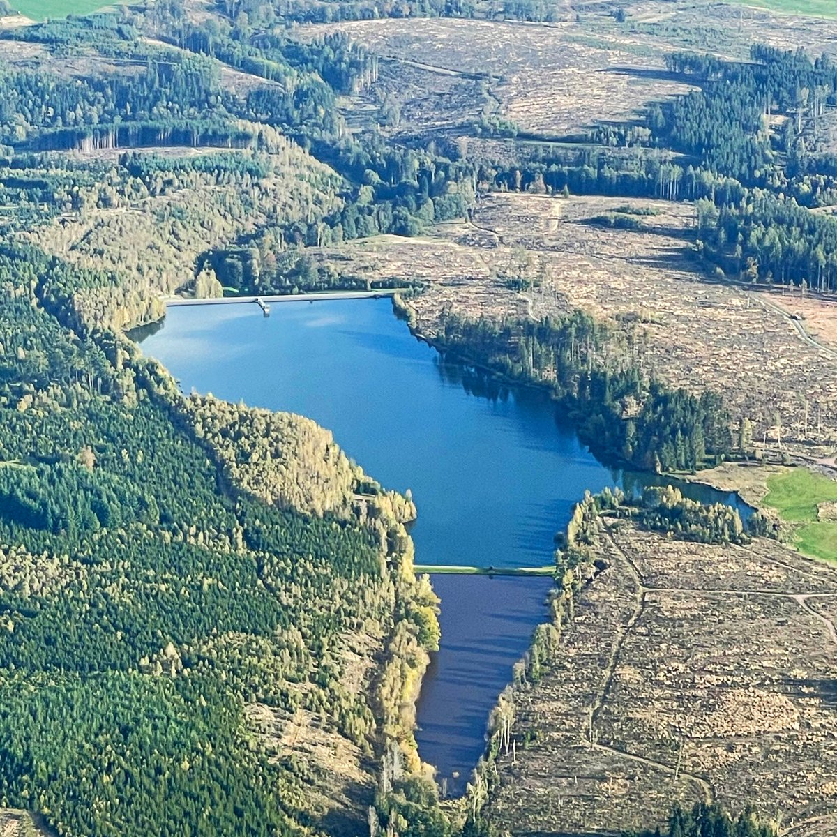
Flug über den gefluteten Steinbruch in Wülfrath. / Flight over the flooded quarry in Wülfrath. #hansaluftbild #steinbruch #see #aerialsurveys #wülfrath #infrastructure #lidar #globalgeosolutions #photogrammetry #analyse #geosolutionconsulting #pilots #aeroplanes #geomarketing

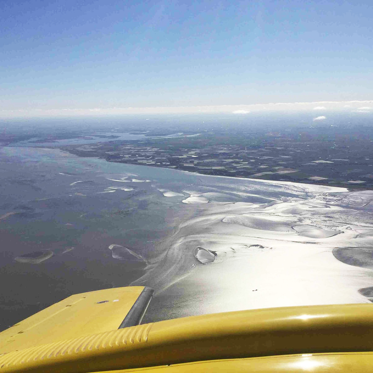
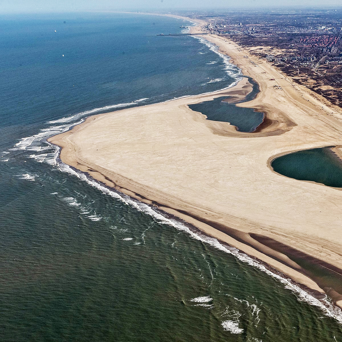
Rückblick – Vermessung der niederländischen Sandküste und den Ästuarien in den Jahren 2011 - 2017. Datenerfassung bei Ebbe mit begrenztem Zeiträumen (>1.000 km, 1pt/qm DSM und DTM in 8 Wochen). #hansaluftbild #netherlands #aerialsurveys #dutchsandy #estuaries #infrastructure


Flug über einen alten Bahnhof nahe Tangermünde. / Flight over an old railroad station near Tangermünde. #hansaluftbild #alterbahnhof #tangermünde #bildflug #infrastructure #germany #lidar #globalgeosolutions #photogrammetry #analyse #geosolutionconsulting #pilots #geomarketing

Blick auf den Bismarckturm in Rathenow. / View of the Bismarck Tower in Rathenow. #hansaluftbild #rathenow #bismarckturm #bildflüge #infrastructure #germany #lidar #globalgeosolutions #photogrammetry #analyse #geosolutionconsulting #pilots #aeroplanes #geomarketing

Werde Teil unseres Teams! AERIAL SENSOR OPERATOR (m/w/d) zum nächstmöglichen Termin gesucht! Weitere Infos und Jobangebote unter: hansaluftbild.de/karriere #hansaluftbild #aerialsensoroperator #operator #projektmanagement #neuerjob #geoinformation #job #muenster #mobilemapping

Blick auf den Brocken im Harz. / View of the Brocken in the Harz mountains. #hansaluftbild #brocken #bildflüge #harz #infrastructure #germany #lidar #globalgeosolutions #photogrammetry #analyse #geosolutionconsulting #pilots #aeroplanes #geosolutions #geomarketing #mapping

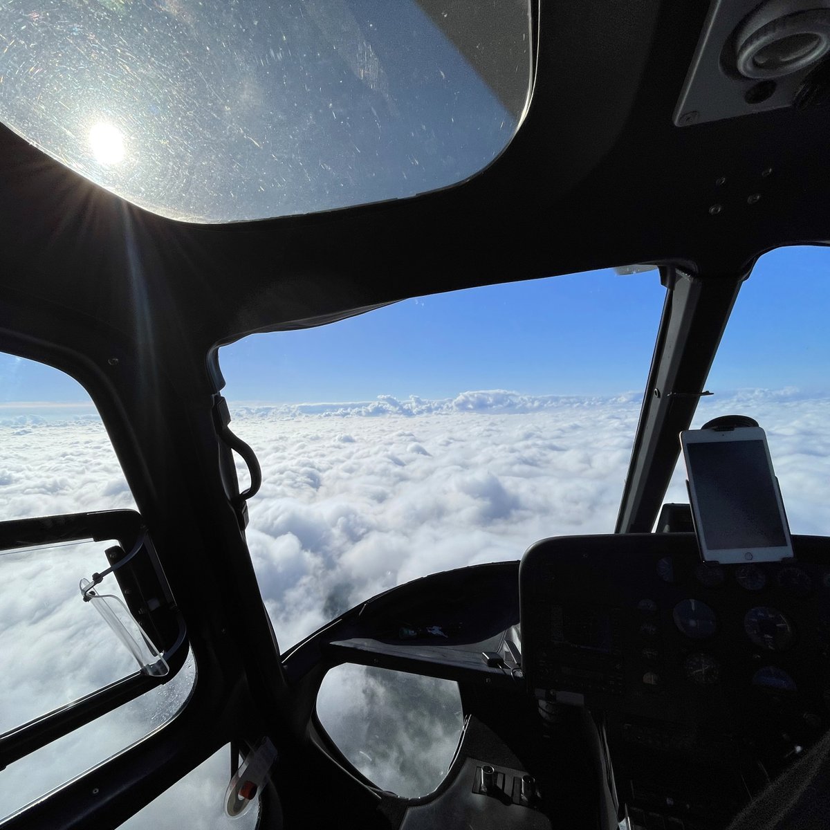
Über den Wolken ... . Flug über Sachsen-Anhalt. / Above the clouds ... . Flight over Saxony-Anhalt. #hansaluftbild #sachsenanhalt #bildflüge #analyse #infrastructure #germany #lidar #globalgeosolutions #photogrammetry #geosolutionconsulting #pilots #aeroplanes #geosolutions


Blick auf den mittleren Harz und den Tagebau Elbingerode aus der Luft. / Aerial view of the central Harz Mountains and the Elbingerode open-cast mine. #hansaluftbild #aerialsurveys #harz #tagebau #elbingerode #bildflüge #analyse #infrastructure #germany #lidar #infrastructure

Happy New Year! #hansaluftbild #happynewyear #2024 #newyeargreetings #neujahr

Das gesamte Team der Hansa Luftbild wünscht frohe und friedliche Weihnachten! / The entire Hansa Luftbild team wishes you a Merry Christmas! #hansaluftbild #seasonsgreeting #christmas #weihnachten #germany #weihnachtsgruss #muenster #aerialsurveys #infrastructure

Die Marienkirche aus der Zeit der Backsteingotik im Zentrum Stendals. / The Marienkirche from the brick Gothic period in the centre of Stendal. #hansaluftbild #helicopterflight #aerialsurveys #infrastructure #marienkirche #stendal #backsteingotik #germany #bildflug #lidar

Flug über den Harz. / Flight over the Harz. #hansaluftbild #helicopterflight #aerialsurveys #infrastructure #germany #bildflug #lidar #infrastructure #globalgeosolutions #photogrammetry #aeroplane #aerialsurvey #bildflug #geosolutionconsulting #geosolutions #geomarketing
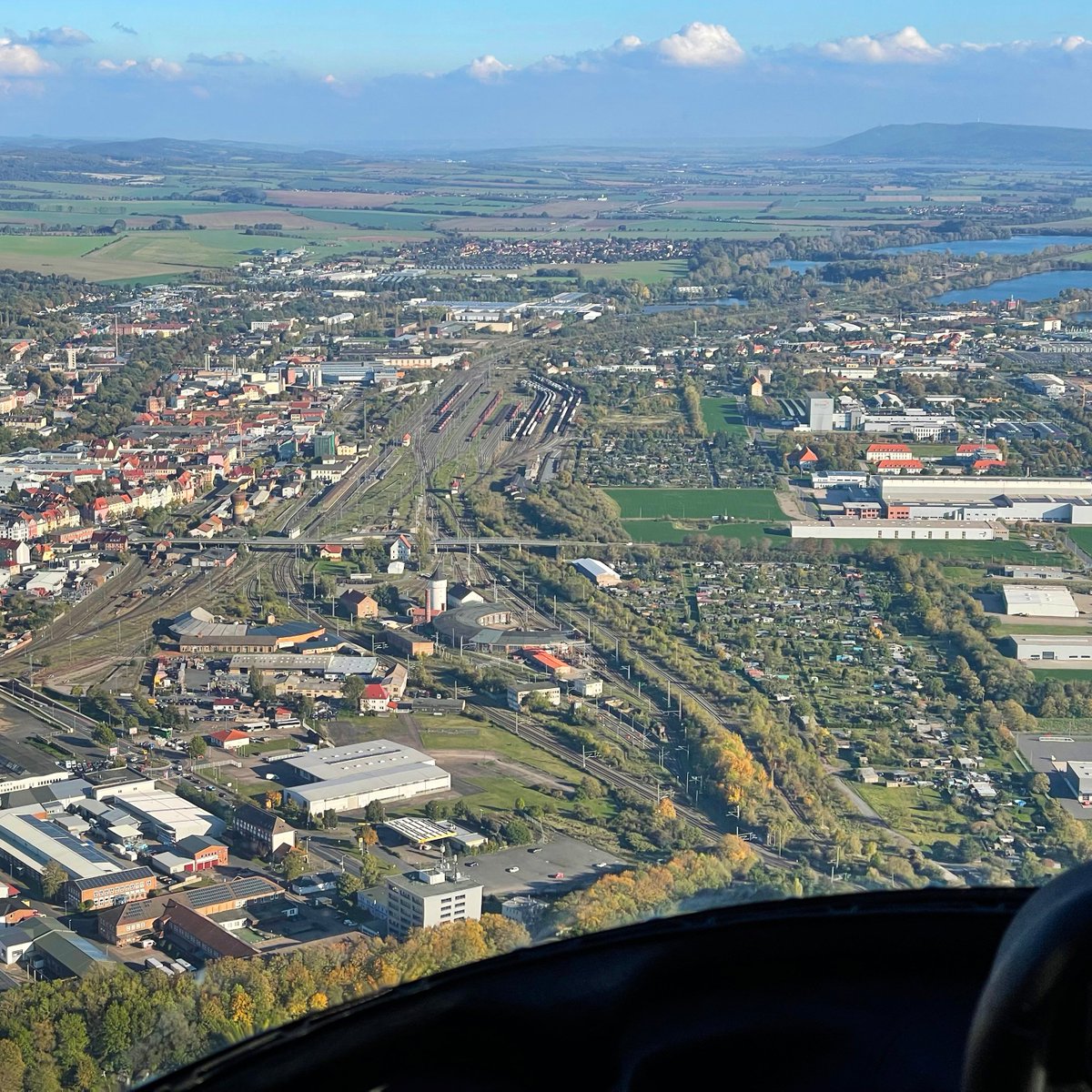
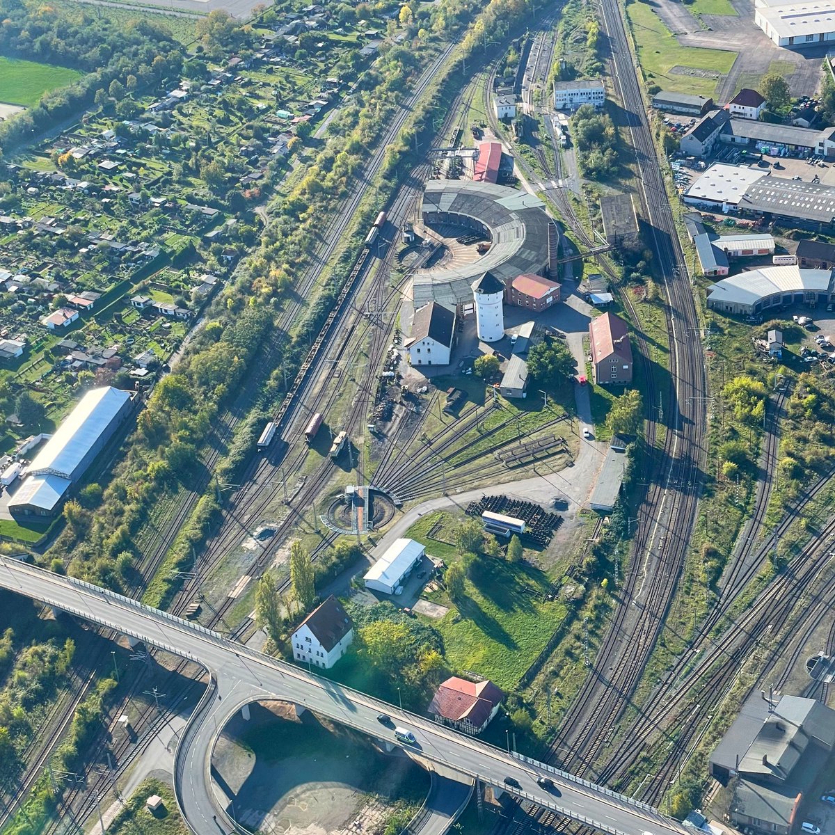
Flug über Nordhausen am Harz. Hier zusehen sind das Bahnbetriebswerk, der Lockschuppen und der Stausee. / Flight over Nordhausen in the Harz Mountains. Here you can see the railroad depot, the engine shed and the reservoir. #hansaluftbild #geoinformation #aerialsurveys


AlTaify3@ @al_taify3
5 Followers 146 Following
Angelina @angelina65basil
184 Followers 3K Following
Levin Glano @LevinGlano
133 Followers 652 Following
MK. @Keneth98K31212
63 Followers 645 Following Son of a farmer, OB NTARE SCHOOL and ST KAGWA BUSHENYI HSCH. Alumni Kyambogo University. Young entrepreneur, Environmentalist.

Percento @Percento
3K Followers 4K Following Creating innovative IT Solutions for business leaders worldwide through cutting edge technologies. #BusinessTechnology #Technology

locr GEOservices & MA.. @locrmaps
670 Followers 808 Following personalized maps & geomarketing solutions | print & cross media
Andreas Möllhoff @x6freak
2 Followers 46 Following
Jonathan Wisser @JonthanMM
35 Followers 22 Following 22 / B. Sc. Geoinformatics at WWU Münster / Gaming / GIS / Web Mapping
Alexander Jenal @alexthegaleks
163 Followers 879 Following
Christopher Chan 陳�.. @broke_chan
272 Followers 4K Following Perpetually confused, trying to be a better human | 🌎🌍🌏🛰️🛰️×💱🔬🔭 =🔺 | Opinions do shift, weakly held
Dagmar Schuster @dieschusters
7 Followers 154 Following
Geo Week News @GeoWeekNews
5K Followers 3K Following Geo Week News covers the intersection between 3D tech, geospatial and the built world. Come see us in 2025!
Tao 涛 @Tao12119815
11 Followers 565 Following Phd candidate in the University of Göttingen | Forest | Remote Sensing | Deep learning
Jonas Klein @KleinJonas
5 Followers 49 Following
AeroDCS Fernerkundung @aerodcs
5 Followers 10 Following AeroDCS bietet eine Palette qualitativ hochwertiger und operativ zuverlässiger Dienstleistungen rund um das Geschäftsfeld der aerialen Fernerkundung.
سند فالح بن .. @sanadfo2030
756 Followers 2K Following (همه سمائنا )صاحب شركه سما العالميه. وشركه سند الجبيل
Sherwan @Shero3323
51 Followers 413 Following
Derecho Agrario y Amb.. @VILCHIS__MX
578 Followers 5K Following Las modificaciones al artículo 27 constitucional, desde su promulgación en 1917.
Martin Kiesow @MartinKiesow
1 Followers 6 Following
Martin Dicks @MartinDicks3
0 Followers 9 Following
Hanna Meyer @hanna123987
1K Followers 367 Following Researcher @WWU_Muenster, working on remote sensing of the environment, machine learning, spatial data analysis, R.

Moskito GIS GmbH @GisMoskito
16 Followers 50 Following Moskito - Das GIS für alle Fälle mit besonderem Augenmerk auf Leitungsdokumentation für Kommunen und Versorger.
Geo-spatial Informati.. @GsisOffice
828 Followers 999 Following #SCI #EI JOURNAL Cite Score 7.4 Welcome, peer submissions! We will become better with you!
Frederik Diehl @FrederikDiehl_
18 Followers 134 Following Software Developer @LGLN_Developers | AI-Team
Balazs Tran @BalazsTran
3 Followers 30 Following
Guido Patz @gp_pm
398 Followers 4K Following

SunGeomatics @SunGeomatics
196 Followers 1K Following GeoSpacial Services, GIS, LiDAR, Mobile Mapping, Photogrammetry, Orthophoto & BIM
Potel Jossam @jossam2003
177 Followers 786 Following Executive Secretary Eastern Africa Land Administration Network (EALAN), Lecturer at Ines-Ruhengeri Senior Land tenure Specialist Landesa
Tunde Kallai @tkallai
2K Followers 4K Following Senior expert of RTD & Open Innovation models/strategies/ apps & Living Labs .Certified European Start-up Adviser.
Chaidir A. Adlan @chaidiradlan
1K Followers 5K Following PhD Candidate at @Radboud_Uni | Geoinformatics @utwente alumn | Remote Sensing GIS @ugmyogyakarta alumn | #geogeeks
رمزي القدسي @ramzialkadasi
743 Followers 5K Following
EOPages @EOPages
1K Followers 585 Following EOpages is a #marketplace between the Earth Observation Service Industry & Users powered by @earsc #remotesensing #earthobservation
Christine @die_christine
629 Followers 1K Following blond, Geoinformatikerin, @moehrchenzessin s Mama, Hackse, apokalyptische Rheydterin, im ♥ Münsterländerin, REUTX5Y7, @[email protected]

Julian Kuhlmann @sasquotschi
91 Followers 183 Following UI Engineer, Creator of digital things and Aviator. ❤️ for CSS, VFR and other abbreviations
Hanns Florian @FlorianHanns
2 Followers 14 Following
GIM International @gim_intl
9K Followers 3K Following GIM International focuses on reporting the latest news and communicating new developments and applications in geospatial surveying.
Hofmeister @Hofmeis77112661
0 Followers 1 Following Projektmanager Welthungerhilfe Hansa Luftbild Auslandserfahrungen Flexibilität
Bertolo @uskok_
11 Followers 526 Following
Jörg Haupt @jhaupt2007
467 Followers 879 Following Hier twittert die Jörg Haupt Management Consulting, #Unternehmensberatung für #Strategie, #Marketing & #Organisation
Futurotec Solutions @FuturotecL
560 Followers 5K Following 3D Experience Like Never Before | 3D Holographic Solutions | 3D Content Creation & Development
drone4land @drone4land
419 Followers 330 Following Research and innovation with UAVs to make land rights mapping faster, cheaper, easier, and more responsible
Dimo Todorovski @DimoTodorovski
356 Followers 499 Following Works at Faculty ITC, University Twente. Enschede the Netherlands
#ISPRSgsw @isprsgsw
239 Followers 359 Following The ISPRS Geospatial Week (GSW) is a combination of workshops organised by about 30 ISPRS Working Groups active in areas of interest of ISPRS. It is convened
EO OPEN SCIENCE @EO_OPEN_SCIENCE
15K Followers 854 Following European Space Agency account for the #EarthObservation (EO) #OpenScience user community. Exploring challenges & opportunities created by revolutions in #EO.
GEO Business @GEOBusinessShow
6K Followers 6K Following The event for everyone involved in the gathering, storing, processing and delivery of geospatial information. At ExCeL London 5-6 June 2024. #GeoBusiness
Oracle @Oracle
820K Followers 825 Following Leading the cloud. We help people see data in new ways, discover insights, unlock endless possibilities.
Bentley Systems DE @BentleyGermany
475 Followers 415 Following Bentley Systems bietet umfassende #Softwarelösungen für zukunftsorienterte #Infrastruktur für #Architekten, #Ingenieure und #BauherrenDGPF @DGPF_
83 Followers 6 Following
GIM International @gim_intl
9K Followers 3K Following GIM International focuses on reporting the latest news and communicating new developments and applications in geospatial surveying.
Vexcel Imaging @vexcel_imaging
766 Followers 54 Following Vexcel Imaging is a global leader in aerial imaging, known for developing cutting-edge aerial cameras, mapping systems, and photogrammetric processing software.
Stephan Nebiker @snebiker
906 Followers 706 Following prof for photogrammetry & geoinformatics @igeofhnw; co-founder @inovitasag; 3d mobile mapping, uav, AR, robotics; https://t.co/eM6sGiAnmF; my own views
IGEO FHNW @igeoFHNW
617 Followers 184 Following Institut Geomatik FHNW: BSc in Geomatik & MSc MSE in Geomatics / Institute of Geomatics FHNW
drone4land @drone4land
419 Followers 330 Following Research and innovation with UAVs to make land rights mapping faster, cheaper, easier, and more responsible
iNovitas AG @iNovitasAG
282 Followers 203 Following #infra3D - a #3D, highly #accurate & cloud-based INFRASTRUCTURE PLATFORM FOR PROFESSIONALS. Be on site - analyze | visualize | map | measure & much more
Hexagon Safety, Infra.. @HexagonSIG
10K Followers 624 Following Improving resilience and sustainability for the world’s critical services and infrastructure | Part of @HexagonAB
#geoObserver 🌍🔭.. @geoObserver_
2K Followers 1K Following 1. Brauchen wir keinen Raumbezug und 2. ist die Erde eine Scheibe. 1. we do not need a spatial reference and 2. the earth is a disc.
INTERGEO @InsideIntergeo
4K Followers 563 Following 24 - 26 September 2024 | STUTTGART | The World's No.1 Event for the Geospatial Community | Digital Twins, Digital Mapping, BIM, Smart City, UAV
Business Geomatics @BGGeomatics
1K Followers 1K Following Hier twittert die Redaktion der Wirtschaftszeitung Business Geomatics aus der Welt der Geo-Informationen.
ISPRS @isprs
2K Followers 8 Following
ZENIT GmbH @ZENITGmbH
1K Followers 4K Following Hier twittert das Marketing-Team der ZENIT GmbH / Netzwerk ZENIT e.V. Impressum: https://t.co/GPBjRb59x7 Datenschutz: https://t.co/5ZoE6iHzzy…
ISPRS IJGI @ISPRS_IJGI
2K Followers 1K Following IJGI (ISSN 2220-9964; IF 3.4 is an Open Access journal of the ISPRS and is published monthly online by MDPI. Editor-in-Chief: Prof. Dr. Wolfgang Kainz
Innovation @GEOkomm
322 Followers 627 Following Verband der GeoInformationswirtschaft Berlin-Brandenburg
Arab-German Chamber @Ghorfa_Germany
1K Followers 378 Following Ghorfa Arab-German Chamber of Commerce and Industry, the competence center for business in Germany and the Arab world since 45 years
Afrika-Verein der deu.. @afrikaverein
3K Followers 780 Following Afrika-Verein der deutschen Wirtschaft is the foreign trade association of German businesses with an interest in the African continent.
its4land @its4land1
461 Followers 381 Following We're an EU H2020 project creating 7 new tools to make land rights mapping faster, cheaper, easier, and more responsible
Esri Deutschland @Esri_de
5K Followers 1K Following #LocationIntelligence #GIS Impressum: https://t.co/MSNXnHLHsx
Esri @Esri
193K Followers 70K Following Esri builds #ArcGIS, the leading location intelligence and spatial analytics software for mapping, 3D GIS, imagery, and geospatial app development.
Auswärtiges Amt @AuswaertigesAmt
922K Followers 1K Following Aktuelle Nachrichten aus dem Auswärtigen Amt - Auf Englisch: @GermanyDiplo - Impressum, Datenschutz & Netiquette: https://t.co/RMILLWXov8
Welthungerhilfe (WHH) @Welthungerhilfe
145K Followers 3K Following We are an international nonprofit from Germany fighting for ZeroHunger. With some 3,200 staff worldwide, we support more than 18 million people in 37 countries.
t3n Magazin @t3n
158K Followers 260 Following Netzwerk & Magazin für digitale Zukunft. https://t.co/aKdrgLRhYk
STAY TUNED: A brand new video of our 'I Fly UltraCam' series is about to be released very soon! Are you ready for take off? 🛫 #vexcelimaging #UltraCam #IFlyUltraCam #aerialimagery

It's World Photography Day - let's celebrate the art, craft, science and history of photography! Our UltraCam captures stunning aerial images every day which give you an incredible bird's eye view. Share your favorite photo in the comments! #vexcelimaging #worldphotographyday


Digital Street Survey in Berlin using Mobile Mapping | @hansaluftbild geoinformatics.com/digital-street…

Check our recent publication: Innovative Geospatial Solutions for Land Tenure Mapping ajol.info/index.php/rjes… @drone4land @its4land1 @hansaluftbild @Het_Kadaster @LibITC @LibITC
🛰️ Advantages of @hansaluftbild's services: ➡️Over 90 years of experience in aerial survey and image processing ➡️Three aircraft guarantee flexible and reliable aerial surveys ➡️Innovative solutions and individualised consultancy services More info: hansaluftbild.de/en/services/re…
Statement concerning the impact and the possible effects of #COVID-19 on customer service and on @hansaluftbild operations, from their #CEO Joerg Haupt. ➡️ hansaluftbild.de/en/news-articl…
3D city model for Darmstadt 🇩🇪 ☑️A data collection covering 7,100 ha of the urban area has recently been created. @hansaluftbild has carried out a combined airborne LiDAR and aerial survey of the science city of Darmstadt. 👉hansaluftbild.de/en/news-articl…
Currently ongoing in the its4land booth at AfricaGIS: tools testing and training for African software developers. Welcome! @ITCAlumni @LibITC @EU_H2020 @rohanmbennett @_sereneho @drone4land @SCrommelinck @hansaluftbild @EsriEA @esrirwanda


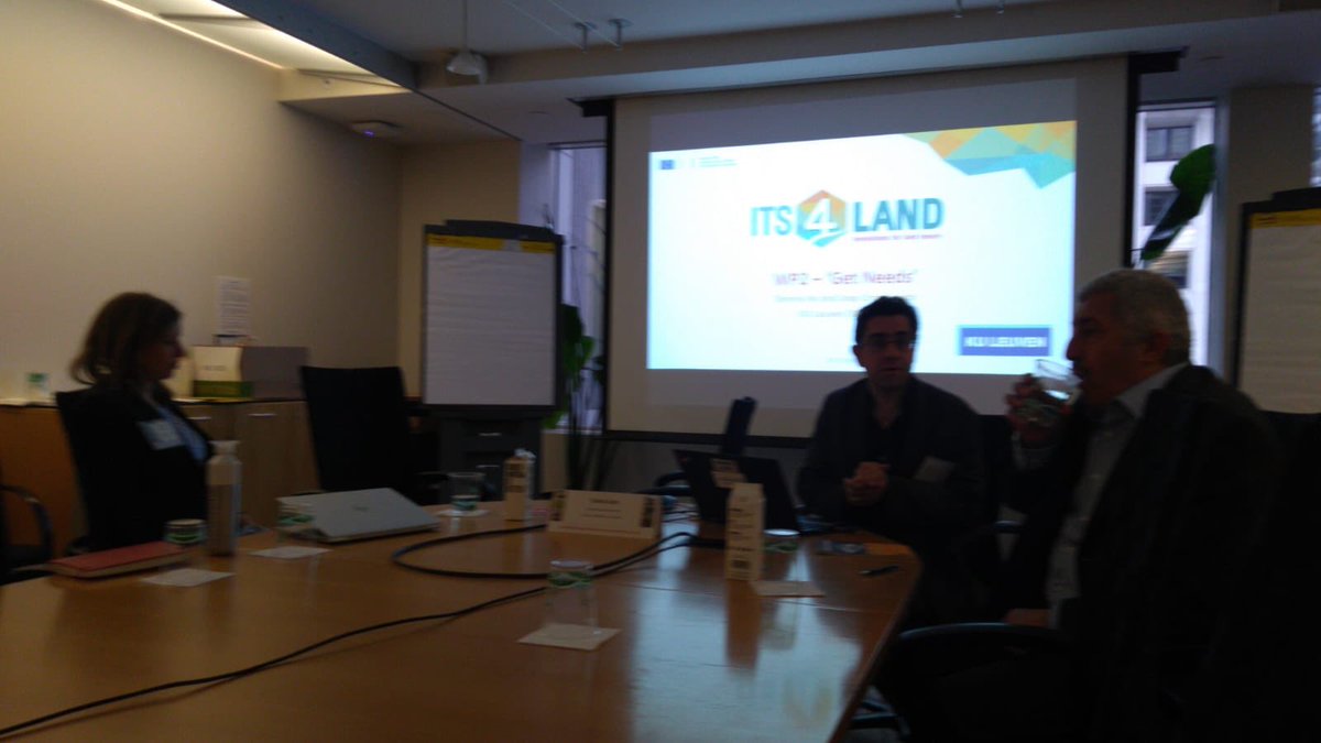
Keeping up the good spirit - roadmap meeting of the @its4land1 crew at the University of Münster. @jossam2003 @MilaKoeva @KasparKundert @SCrommelinck @hansaluftbild @_sereneho


Its4land gave masterclass on the WB conference!!! @drone4land @hansaluftbild @_sereneho @rohanmbennett @ICT_IDEALIST @NCP_Brussels @DimoTodorovski @K_Asiama @ITCAlumni @LibITC


Ok, got the rest of the @its4land1 team this time. About to give a #LandConf2019 masterclass on the tools of the project. @drone4land @hansaluftbild

Great to catch up with the @its4land1 team at #LandConf2019 where we have had a few ppts and a masterclass @drone4land @hansaluftbild #H2020


@petersidro @RegBerlin @krefeldrad @hansaluftbild Heute fliegt er wieder. @julscho

@petersidro @RegBerlin @krefeldrad @hansaluftbild Endlich die Auflösung des Rätsels: Danke an @julscho! Ist ja sinnvoll, dass Vattenfall die Fernwärmenetze überprüft, aber der nächtliche Lärm nervt schon sehr. x.com/julscho/status…

@petersidro @Berlinradlerin @krefeldrad @hansaluftbild Bitte wenden Sie sich an das betroffene Unternehmen bzw. die Oberste Luftfahrt- und Luftsicherheitsbehörde Berlin: berlin.de/senuvk/verkehr…
Off to catch up with the @its4land1 gang for our midterm review in Brussels #H2020 @drone4land @ine_buntinx @SCrommelinck @TechnicalUni @BahirDarUnivers @INESRUHENGERI @esrirwanda @hansaluftbild @LeuvenIO @mchipofya


@VengeanceDE @erlangen_gis @hansaluftbild Vielen Dank für den Hinweis, Aktuell sind wir dran, den Fehler zu beheben. Sind mit der FAU bereits in Kontakt.

@erlangen_gis @hansaluftbild @ER_Stadtwerke Gibt es größere Probleme mit Luftbild oder kommt es bald online?
Spreading the word about the @its4land1 project to a new audience in Melbourne @LeuvenIO @drone4land @mchipofya @SCrommelinck @hansaluftbild
Dr @_sereneho from @KU_Leuven and @UniMelb outlines to #SSFuture18 how we can use emerging technologies to ensure all people have access and control over land by 2030 for a #smart #sustainable future


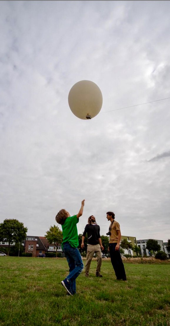
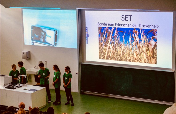
Der große Finaltag vom #senseBox #Hackathon mit Testflug und Vorstellung der #Projektideen. Die Jury @DLR_de, @items_GmbH, @hansaluftbild und KiMM e.V. entschied: Gewinner des Stratosphärenflugs (13.10) ist SET mit der Sonde zum Erforschen der Trockenheit. Wir gratulieren 👏

Trends for United States
You might like