Search results for #idwx
Since we have received small hail & graupel reports from today's activity, you can refer to this handy chart (care of @NWSSacramento) to see what you're getting in your area. If you get either, please let us know via pix or by mPING. We like whatever info we can get! #wawx #idwx


Ahh yes, it's that time of year again. The time where everyone asks us, "What IS graupel, anyway?" Our friends at @NWSSacramento put together this great image to help explain. Graupel showers will be present today & tomorrow, so now you know! #mtwx #Montana #idwx #Idaho


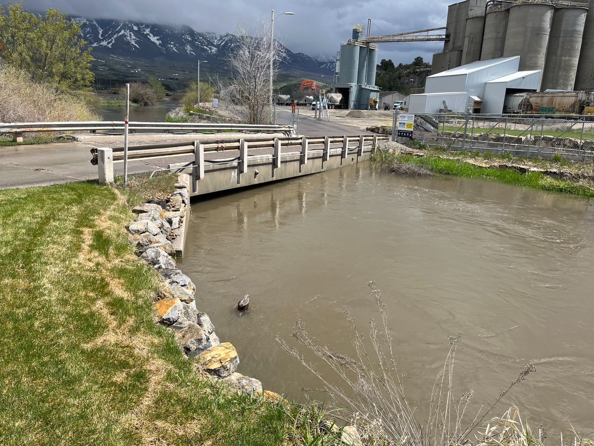
We're seeing high flows and moderate #flooding this week on many eastern #Idaho streams. This is the Portneuf River at Inkom, where we recently installed a new streamgage: waterdata.usgs.gov/monitoring-loc…. #USGS #streamgage #idwx
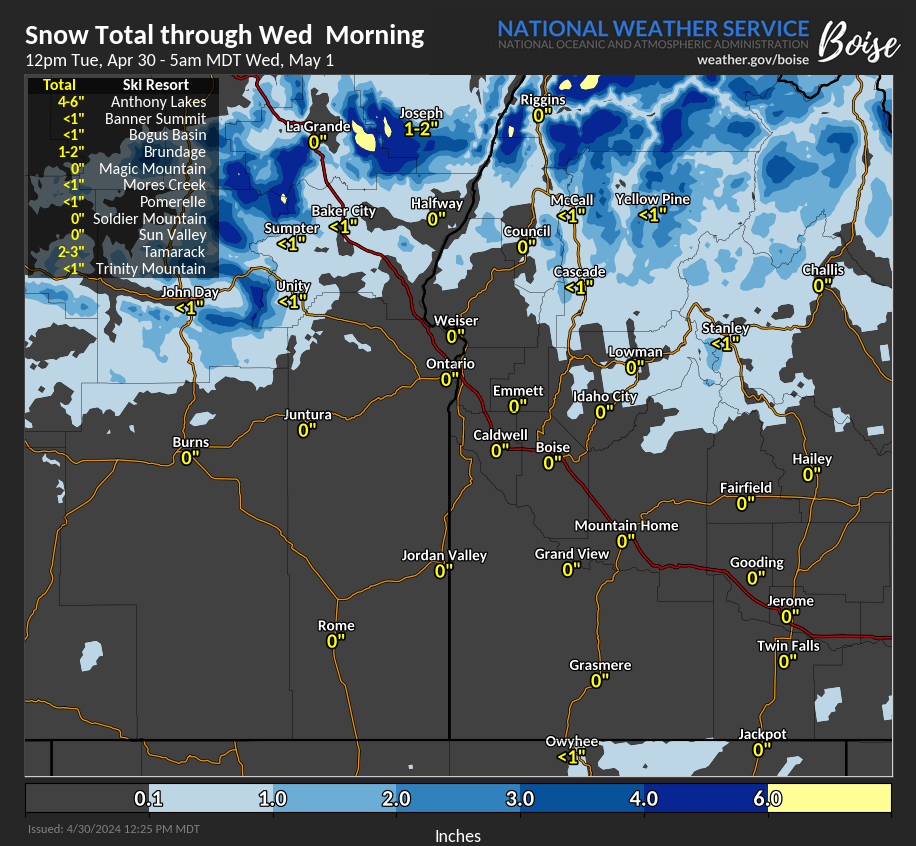
More showers today, with a few t-storms possible this afternoon south. Another localized shower potential Wednesday and Thursday. Here is one model depiction of the possible evolution of these showers. For details: weather.gov/spokane #wawx #idwx


Temperature readings at the 5 o'clock hour this morning. A fair amount of 20s and 30s, values about 10 degrees below normal. Chilly. For more observations go to: wrh.noaa.gov/map/?obs=true&… #wawx #idwx

[5:20 AM PDT] Quick look at some of the passes this morning. Bits of snow/slush seen on some of the higher ones. Report at Stevens Pass says "Mostly bare and wet, with snow and slush in places." More road reports: wsdot.com/travel/real-ti… 511.idaho.gov #wawx #idwx


Another spring day in East Idaho, another Wind Advisory. Seriously. Gusts > 40 mph are expected across the Arco Desert and Upper Snake Plain between 1 pm this aft and 9 pm this eve. Expect another night of cold temperatures, and another Freeze Warning. #idwx


Yesterday's cold front brought some strong wind gusts to the Treasure Valley. Gusts tore down trees like the blue spruce in the photo below. Winds will not be as strong today, however gusts could reach up to 24 mph in Boise this evening. #IDwx 📸Wayne Richey


HIGH risk on D1-2, MDT on D3 in NW US esp near #Seattle,#Tacoma,#Spokane,#Kent,#BellevueWA,#VancouverWA,#Portland,#Salem,#Eugene,#Gresham,#HillsboroOR,#Boise,#Missoula cities #Wxtwitter #WinterWX #WinterStorm #Snowfall #WAwx #PNW #PNWwx #ORwx #Snow #MTwx #IDwx


HIGH risk on D1-2, MDT on D3 in NW US esp near #Seattle,#Tacoma,#Spokane,#Kent,#BellevueWA,#VancouverWA,#Portland,#Salem,#Eugene,#Gresham,#HillsboroOR,#Boise,#Missoula cities #Wxtwitter #WinterWX #WinterStorm #Snowfall #WAwx #PNW #PNWwx #ORwx #Snow #MTwx #IDwx https://t.co/CK8XRLzIXm


Highs will stay well below average today following yesterday's cold front. Wind gusts won't be as extreme, however, we could see gusts up to 24 mph in Boise today. Skies will be clear most of the morning with more clouds this afternoon. #IDwx More Below⤵️ idahonews.com/weather/treasu…
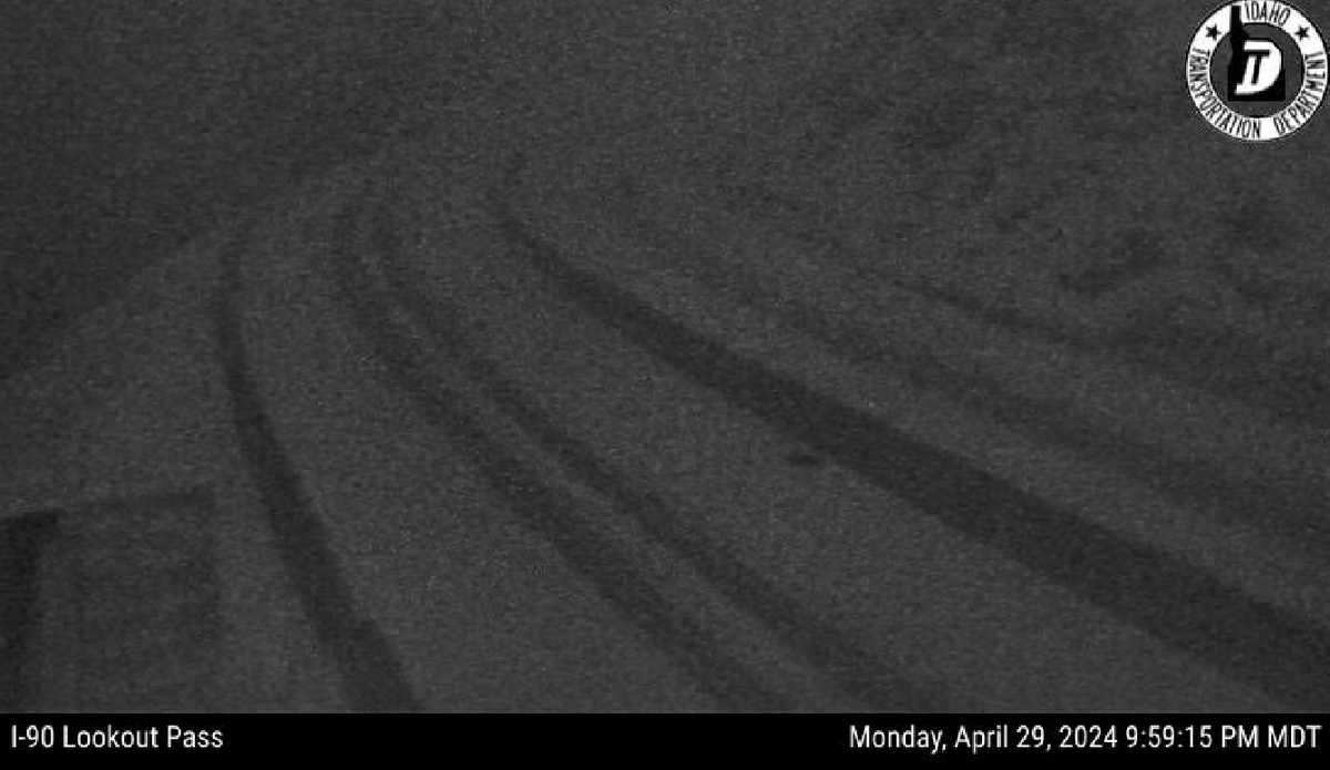
9 PM PDT: It may be a little hard to see since it's dark, but a brief but heavy snow shower over Lookout Pass turned the road white in the past 15 minutes. The snow shower should exit this area by 930 PM PDT. Use caution if traveling in this area. #idwx

Iva De @idwx
3 Followers 9 Following Kkkkk RT victorwerben1: xandnax IAI XANDYY SANTOS É CAMPEÃO E NEYMAR ACABA DE FICAR ALGUNS MILHOES DE EUROS MAIS BONITO RSRSRSR
#idwx Social @idwxSocial
77 Followers 50 Following User reported, user contributed. Send Idaho Weather reports using #idwx! Follow @idwxSocial to keep up with current Idaho weather! Part of @SocialWeatherUS.
D10 @idwx10
17 Followers 10 Following

みな @vU6idwxIQ7XrStN
49 Followers 27 Following ステージ4の乳がんで現在手術は受けられず抗がん剤治療中です(⌒-⌒; ) 副作用がちょっと辛い。発覚から5年まだ生きてます。😅
azuul @idwx_kw
5 Followers 9 Following
Mandy M. McBroom, MPH @EpipilotIDWx
120 Followers 114 Following Clinical Epidemiologist | Biophysics | Biometeorology (ID spread vis-à-vis climate change) | Biostats | Tox & Pharm | Wx forecasting-Penn State| Multilingual


ILL-YES @idwx91
144 Followers 174 Following

Dada kun-ere @zlwk0WDn7idwxAY
14 Followers 17 Following
さくま @PxF9u195jIdwxAl
25 Followers 29 Following
𝕴𝖉𝖎𝖑 @idwx25
15 Followers 24 Following

🐒 @Idwx1FEngYRC9WY
2 Followers 2 Following

عدي الدراجي @9dO57vIDWxJhtfq
11 Followers 42 Following

おにぎり🐏 @3idwxBC6tfc472v
9 Followers 102 Following
Chirs @BEom2h2tIDwxRbG
10 Followers 331 Following
星河鹭起 @RJJbxRJydIdwx9W
2 Followers 31 Following


وليد الخراز @IdwxLo7UTekz8ZM
0 Followers 0 Following


カズボー @i8sKphLVNhIdwxX
8 Followers 26 Following
idwx_ @idwx_
3 Followers 30 Following

土屋智子 @R7IDWX2c5CflN4o
0 Followers 3 Following

蝉哥 @9W1HFDpIDwxQF3u
1 Followers 0 Following

حسام علي سا�.. @u8KZXEwIDWxUU86
2 Followers 6 Following

mana @V32YDS8n1PkIDWX
29 Followers 46 Following
Надежда Чих.. @nHrtvc04mnIDwx4
1 Followers 10 Following


ايهاب @wQZkIdwxViMRTyb
2 Followers 115 Following

عبده البلاح @IdwxZdo38gJlBXB
1 Followers 9 Following عبده البلاح من مدينة بورسعيد مدير وصاحب مكتب ملك للتسويق والاستثمار العقارى ببورسعيد
ひとし @uIdwxU10CBmZNGc
2 Followers 3 Following
Audria Crehan @Annmarie_idwx
1 Followers 82 Following thinks that beer makes you feel the way you ought to feel without beer
بلال محمد @Egf5mKBLdhIDwxT
4 Followers 44 Following


hanuman rodge patil @idwxE3xy7wsufNw
1 Followers 24 Following
xs2idwx9s5fa31 @xs2idwx9s559318
0 Followers 0 Following
+66994711581 @QvDJVvFbeIdwxOG
2 Followers 66 Following
ايمن عوض @CVHPC5XDsCzIDWx
2 Followers 9 Following
123 @KnIDwxUA7319487
0 Followers 43 Following

。、 @IDWx0WbCWY83133
0 Followers 0 Following

Оля @sMH6v3X85EsIdwx
0 Followers 5 Following
iDWX 123 @Hehdhej148718
0 Followers 1 Following
虹空くりす @ZySeh00aF5IDWxK
0 Followers 19 Following
gene @AIvcIdwxPR3x1Tl
1 Followers 2 Following
idwx3 @idwx3117053
1 Followers 6 Following
大久保秀哉 @IDWxUkyN1J6MNuR
0 Followers 0 Following
الطاغي @DlThfsqrIDWx8yy
0 Followers 0 Following
Idw_x2 @idwx_22
10 Followers 68 Following
大野佳祐 @XYlt7aIdwx1k9Qu
0 Followers 5 Following
オフオフ @8WsIDwxItLG56XL
0 Followers 1 Following

かーまいん @7oIdwxEUGQ3912
0 Followers 1 Following

ララカ @km4idwx07
0 Followers 0 Following

junko @IDwxLDdQovdIlRV
0 Followers 13 Following
鈴っと @ppeBVj330idwxI4
0 Followers 5 Following
กฤตพร ท�.. @IDWxKjWDDcqzE5Q
0 Followers 43 Following

فهد @7Q79IDWxQ5Dzcfp
0 Followers 1 Following
野鳥オオルリ @IDWxLqjxDJKfwFQ
0 Followers 1 Following
معاذ رواشده @5xIDwxKZAtLaU25
0 Followers 37 Following
Throbbing @IDwxL7Qvspotucw
1 Followers 13 Following

saved @baIdwx
1 Followers 0 Following
ラスクの裏側?.. @pS8sIdwxHBTnESP
0 Followers 0 Following
คนไง ไม�.. @wIDwxY1WtYdO3YS
0 Followers 0 Following
嶋川良滋 @8EdrwnIDWx62186
0 Followers 1 Following
ق @IDWxPwT9DS9dzY3
0 Followers 1 Following
高橋清 @JBBQ7IDWxM4xnEd
0 Followers 1 Following
عديم @IDWxM9MjTnePFah
6 Followers 49 Following
ヨシダマサユキ @dVWisBTh0idwxC7
0 Followers 0 Following
Idwx Co @idwxcojakarta
0 Followers 1 Following IDWX adalah forum jual beli jam tangan mewah baru dan bekas di Indonesia yang kini berubah menjadi sebuah platform e-commerce
حمزه حسين @4Hi4f2qMIsIDWxV
1 Followers 1 Following
محمد @4IDwxZ1Reeh7SeE
1 Followers 0 Following
يوسف المنذر.. @Idwx1DWwmMljweC
1 Followers 0 Following
吉定文 @Q4JwK0SmWrIDwxO
1 Followers 1 Following
محمد @vIDwxIAUcO9ej9g
3 Followers 9 Following
흔한 @6c1ycrv6ut7IDWX
1 Followers 0 Following