
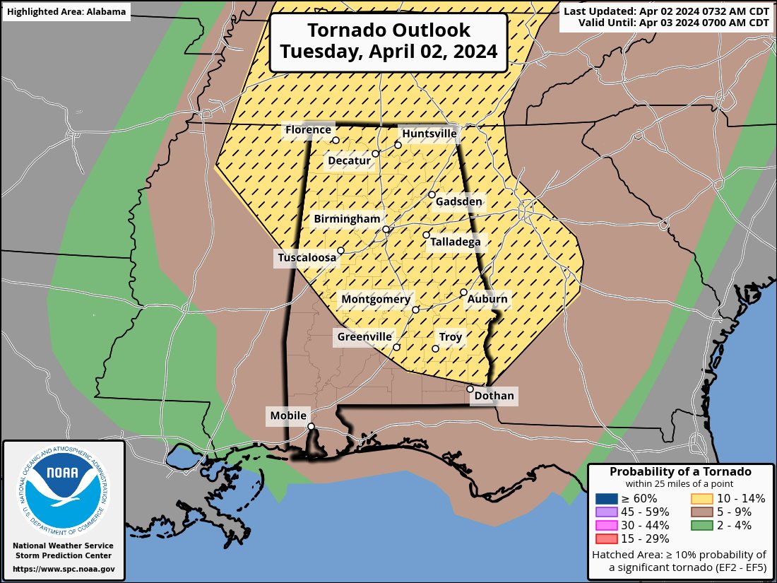
UPDATE: SPC now has much of Alabama in an “enhanced risk” (level 3/5) late this afternoon and tonight. The thinking is that with an increase in the low-level jet after dark, the severe thunderstorm threat could increase over the southern half of the state as well as North Alabama. This is still a very conditional threat… with the main surface low and dynamic forcing well to the north, hopefully we’ll just get away with some strong storms with hail and gusty winds. But, everyone needs to be weather aware through tonight and have a reliable way of getting warnings in case it gets rough. The hyperbole surrounding this system across social media is off the charts. If you have weather anxiety, please don’t be anxious over this situation. Events like this are very common in Alabama during the first week of April; nothing unusual at all. Get the warnings, have a plan, and we will get through the event together just fine.


@spann With these changes by the SPC is the severe threat for the northern half of the state increasing in intensity or is this a wait and see game? Curious I'm heading to Cullman sometime after lunch and it'll be a 3 hour drive and will be up there for two or three days.


@spann Appreciate how level headed you are and how you educate people on what is going on.

@spann It’s a normal day in lower Alabama. Thanks for always keeping your forecasts closer to reality.


@spann It’s to your credit that you understand the concerns of those of us who have lived through tornado outbreaks. Thank you for bringing calm and clarity to every situation, sir.

@spann @mariannekrogers Signs & Wonders Brought to you by GOD ! AKA (Birth Pangs) During the End Times, you will Know " I AM coming " Yiipeeeeeeeeeeeeeeeeeeeeeee !

@spann If the world only had more calm, level headed Met people like you James. The severe wx fanatics and storm chaser community go ballistic. Keep up the good work.👏🏽👌🏽