GeoWing Mapping @GeoWingMapping
A geomatics company that provides high-end mapping solutions. geowingmapping.com Joined February 2016-
Tweets64
-
Followers80
-
Following124
-
Likes36
"Surveyors report their primary work performed involves boundary, cadastral, topographic, and engineering design surveys." pobonline.com/articles/10141…
Have you made your summer travel plans yet?geoawesomeness.com/awesome-map-vi…
A different type of 'fireworks' show for the 4th of July. youtube.com/watch?v=kBvpn4…
GeoWing will map until the cows come home.


Patrick Stewart presents Scientific and Engineering Awards to John Coyle, Brad Hurndell, Vikas Sathaye and Shane Buckham for the concept, design, engineering and implementation of the Shotover K1 Camera System.
A year ago we GeoWing mapped this washed out bridge in Contra Costa County.
After a hard week of drone mapping it's time to fix up a cocktail. "Why use drones to shake/stir cocktails? . . . because it's awesome."
And the award goes to . . . Shotover K1 Camera System. Sir Patrick Stewart announces the Sci-Tech award for the Oscars.
We had a great time at the ASPRS-ILMF Conference in Denver this past week!


Drone Mapping Under Vegetation Canopy - @GeoWingMapping uses drones for detailed maps of collapsed roads and landslides - under trees!

Each partner adds unique value . . . Hawk = drones, SkyIMD = planes, GeoWing = geographic map products! @hawk_aerial @SkyIMD Dream Team.

GeoWing Mapping announces partnership with @hawk_aerial & @SkyIMD providing US aerial coverage! #aerial #mapping ow.ly/CMSu30cBnSj

Santa Rosa and we will also have a presence at the San Francisco event. Angela is presenting a paper about the evaluation of orthomosaics
Excited to be a part of GIS Day 2016. Geomatics Analyst, Angela Kim, will be presenting and representing GeoWing at the North Bay event in

Interested becoming ASPRS-certified? Alan Mikuni from GeoWing will present at ASPRS UAS Mapping 2016! @ASPRSorg

Marsh Vegetation Classification using UAV presented by Becky Morton at ASPRS UAS Mapping 2016 @ASPRSorg


Sara Kinney @SaraEKinney
1K Followers 102 Following
Geowin smg @SmgGeowin
12 Followers 209 Following when you have a problem if there is a solution why do need to worry , when you still have a problem if there is no solution , then why do you worry #smg

Pest Prophet @PestProphet
3K Followers 4K Following App that puts #agriculture pest and disease models into the hands of #farmers without any hardware needed. Learn more at https://t.co/72UrSRO4V7

Atlantic @AtlanticGrp
482 Followers 3K Following passionately driven | purposefully different Atlantic is a technology-driven remote sensing, surveying and consulting business. #geospatial

OF Small Business @OFSmallBusiness
435 Followers 560 Following CDFI dedicated to lending to small businesses in California. RT and follows are not endorsements.
Drone Rescue Systems ... @drone_rescue
786 Followers 2K Following We are awarded by the European Space Agency, developed the fastest and most efficient parachute safety solution for drones available on the market right now.
Stakemill @Stakemill
1K Followers 3K Following A small Land Survey Equipment Supplier that also cuts wood survey stakes, we are one of Florida's Largest and Oldest suppliers of Survey Equipment.
Cliff Stewart @cliffstewart214
96 Followers 2K Following
Sophia @SEGigliotti
14 Followers 197 Following
Eric Cenovich @EricCenovich
12 Followers 39 Following
Terry McNabb @aquatechnex
758 Followers 1K Following Aquatechnex Preserves, Protects and Restores our freshwater lakes and rivers impacted by invasive aquatic species and toxic algae
Geo-matching.com @Geomatching
18K Followers 19K Following https://t.co/3gwCkbV0gR The world’s largest product platform for surveying, positioning and machine guidance.
James Berglund @JamesEBerglund
51 Followers 148 Following
SkyIMD @SkyIMD
180 Followers 135 Following SkyIMD develops FAA STC-approved aerial imaging solutions for manned aircraft. Aerial photography, imaging, mapping and data (remote sensing) too.
SkyData Precision, In... @SkyDataPrecis
142 Followers 921 Following
Hawk Aerial @hawk_aerial
204 Followers 451 Following Hawk Aerial - experienced drone pilots & partner with Aerobotics. High def mapping for better quality vines.
Steve @steves01x
1K Followers 3K Following
The Map Center 🗺�... @EcoAndrewTRC
2K Followers 2K Following Owner of 'The Map Center' in Pawtucket RI https://t.co/7Y1fU2pq6m Still getting my Mastodon legs but @[email protected] @ecoandrew bsky
George Ginis @gginis
153 Followers 212 Following Communication systems, Internet access, Networks, Algorithms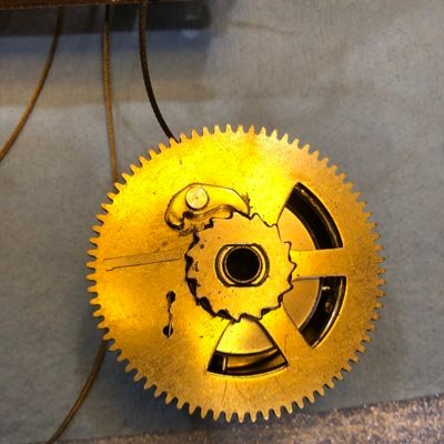
Out of Time Clockmake... @InThinIce
509 Followers 3K Following Clockmaker. Bystander priest. Thawing poet. Also known as Scott McCloud, the Cloudykid.
SOJ Surveying @sojsurveying
473 Followers 362 Following Licensed Land Surveyor California/Nevada, ASPRS Certified Mapping Scientist-UASThe Mapping Network @MappingNetwork
704 Followers 391 Following The Mapping Network is a nationwide group of professionals providing the Hydrographic / Sediment Surveys and UAV/Drone Mapping -FAA licensed sUAS remote pilots
thedronetravel @thedronetravel
564 Followers 2K Following Everything you need to know about #drone, drone #travelvideos and accessories for #dronelovers across world.
Mike Miller @millermountainl
2K Followers 3K Following GIS Nerd, Conservation Biology, Open Source Web Mapping, Leaflet, PostGIS, TurfJS, Merging conservation and GIS to make the world better https://t.co/51EOjt5kuU
Drone Pusher @DronePusher
1K Followers 3K Following Purveyor of Fine Drone Products & Technology (A follow, tweet, or re-tweet does not mean endrorsement)
Terra Remote Sensing @TerraRemote
2K Followers 3K Following International Survey and Mapping Service company specializing in LiDAR, Hyperspectral, Thermal, Digital Orthophotography, Marine Bathymetry, and GIS services.
Microdrones @MicrodronesUAVs
2K Followers 632 Following Complete UAV / drone solutions for specific applications like surveying, mapping, inspection, construction, mining, precision agriculture, & more.

Ramanand Nivghekar @ramnivghekar
1K Followers 5K Following “Senior Architect ( Enterprise EAM) ”, AZ305, AWS SAA-C02, TOGAF.. #Innovation #IoT #AI #ML #Robotics #Cloud #ChatBot #Telepresence #Roboticassistant

Derek Smith @mapsnotrocks
37 Followers 179 Following
LP360 @LP360_GC
57 Followers 140 Following The World’s Most Powerful GIS Environment for LIDAR and Photogrammetric Point Cloud Processing
Survey Pro @SurveyProShop
816 Followers 3K Following Survey Pro is dedicated to bring you quality products you can trust at the best prices
Martin Copping @mgcopping
3K Followers 2K Following Product Manager for Dashboards @ Esri | Liverpool FC Supporter | Jamaican Living Abroad | Full-time Sneakerhead
Simon Varney @varneynz
51 Followers 1K Following
Wayne Junius Ozmore, ... @OzmoreWayne
2K Followers 5K Following VIRGINIAN | Husband, Dad, Christian | Previous: Cyber | ALJ @ VaABC | VaOAG Investigator | LEO | ENTJ | GEOPOL - VA GOP 4th CD Chair | Navy Intel | SW Asia x3 |
Shari Kamimori @3DVDT
77 Followers 138 Following Using 3D Imaging Technology to capture and document the built environment for the building and historic preservation industries.
Natbat (Bluesky/Insta... @Natbat
6K Followers 3K Following Enthusiastic adventurer, artist, conservation technologist, tidepool docent and California Naturalist. 🦇🦭🦀(🐺🐥🐰) @[email protected] @natbat.bsky.social
RPLS @RPLScommunity
5K Followers 2K Following RPLS dot com (previously known as SurveyorConnect) offers Community Forums and Resources for Land Surveyors & Geomatics Professionals.
Vivent @PhytlSigns
1K Followers 2K Following Vivent biosensors help growers optimise climate conditions by managing plant health in real-time #sustainableagriculture #agtech #planthealth
Amanda O'Connor @asoconnor
2K Followers 4K Following Hyperspectral, SAR, ENVI, IDL, current employee of co formerly known as RSI, travel, RemoteSensing, deeplearning, severewx, chortling, fire. Tweets are my own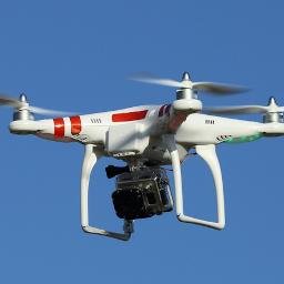
Popular Drones @populardrones99
36 Followers 47 Following
SITTM Corp @SittmCorp
2K Followers 4K Following UAV, FPV enthusiast. 3D printing. Promoting drones in commercial uses.

NWB Environmental @NWB_Enviro
21 Followers 52 Following NWB Environmental Services is a San Diego based environmental services firm specializing in archaeology and unmanned aerial data collection.
David Yoel @DavidYoel11
9 Followers 41 Following

Commercial Drones FM @DronesPodcast
4K Followers 995 Following Commercial Drones FM is the podcast for the drone industry. It explores the people, concepts, & industries that use drones for business. Hosted by @SkyCapture
GIS Day @gisday
28K Followers 9K Following Celebrate GIS Day on November 20, 2024! Show how GIS makes a difference in your community and in the world.
What is GIS? @GISdotcom
23K Followers 15K Following GIS lets us visualize, question, analyze, interpret, & understand data to reveal relationships, patterns, & trends.
GIS and Science @GISandScience
30K Followers 10K Following Sharing issues and applications of geospatial technology for scientific research and understanding. Tweets by the @Esri Science Team with @deepseadawn
Out of Time Clockmake... @InThinIce
509 Followers 3K Following Clockmaker. Bystander priest. Thawing poet. Also known as Scott McCloud, the Cloudykid.
James Berglund @JamesEBerglund
51 Followers 148 Following
Mauricio Simon @m72simon
1K Followers 3K Following Papa orgulloso, Ingeniero Agrónomo, y amigo de mis amigos.
Jason Leary @jasonlcvcmn
4K Followers 5K Following Dad, Farmer, Ag Technology Manager at Crystal Valley @crystalvalleymn

Lisa Prassack @LisaPrassack
7K Followers 8K Following CEO @PrassackAdvsrs Innovation & Technology Expert & Data Strategy - #Agriculture & Food 🌐 🌱 Food, Feed, Fuel & Fibre - Energy - #ESG
Dronepedia @Dronepedia
4K Followers 1K Following All the best images of/made by drones. Interesting facts about these cool flying objects and some ideas on how to use them for some unforgetabble fun!

Roger Lancaster @RogerLanc
16 Followers 57 Following Land Surveyor; University of Nevada BSME & Ski Team; Owner, Lancaster Land Surveys

Juan Carlos Herrera @jcherrera
584 Followers 4K Following Digital Transformation (IMD). Cloud Architect, Developer & Instructor (Google & AWS). Former Sun Microsystems Java Instructor & Consultant.
Lauri Hartikainen CEO... @pointsceneCEO
549 Followers 1K Following CEO @ Pointscene Oy Ltd Solving the constant change in construction projects and improving situational awareness with streamlined reality information flow.
Sophia Garcia @_sophiam_garcia
330 Followers 743 Following Esri Industry Solutions Specialist for Equity & Civic Nonprofits, Wellesley alum, Environmentalist, GIS nerd, raft guide
Sara Kinney @SaraEKinney
1K Followers 102 Following
Popular Drones @populardrones99
36 Followers 47 Following
SITTM Corp @SittmCorp
2K Followers 4K Following UAV, FPV enthusiast. 3D printing. Promoting drones in commercial uses.
NWB Environmental @NWB_Enviro
21 Followers 52 Following NWB Environmental Services is a San Diego based environmental services firm specializing in archaeology and unmanned aerial data collection.
Amanda O'Connor @asoconnor
2K Followers 4K Following Hyperspectral, SAR, ENVI, IDL, current employee of co formerly known as RSI, travel, RemoteSensing, deeplearning, severewx, chortling, fire. Tweets are my own
Vivent @PhytlSigns
1K Followers 2K Following Vivent biosensors help growers optimise climate conditions by managing plant health in real-time #sustainableagriculture #agtech #planthealth
Natbat (Bluesky/Insta... @Natbat
6K Followers 3K Following Enthusiastic adventurer, artist, conservation technologist, tidepool docent and California Naturalist. 🦇🦭🦀(🐺🐥🐰) @[email protected] @natbat.bsky.social
RPLS @RPLScommunity
5K Followers 2K Following RPLS dot com (previously known as SurveyorConnect) offers Community Forums and Resources for Land Surveyors & Geomatics Professionals.
Wayne Junius Ozmore, ... @OzmoreWayne
2K Followers 5K Following VIRGINIAN | Husband, Dad, Christian | Previous: Cyber | ALJ @ VaABC | VaOAG Investigator | LEO | ENTJ | GEOPOL - VA GOP 4th CD Chair | Navy Intel | SW Asia x3 |
Martin Copping @mgcopping
3K Followers 2K Following Product Manager for Dashboards @ Esri | Liverpool FC Supporter | Jamaican Living Abroad | Full-time Sneakerhead
Survey Pro @SurveyProShop
816 Followers 3K Following Survey Pro is dedicated to bring you quality products you can trust at the best prices
LP360 @LP360_GC
57 Followers 140 Following The World’s Most Powerful GIS Environment for LIDAR and Photogrammetric Point Cloud Processing
Derek Smith @mapsnotrocks
37 Followers 179 Following
Ramanand Nivghekar @ramnivghekar
1K Followers 5K Following “Senior Architect ( Enterprise EAM) ”, AZ305, AWS SAA-C02, TOGAF.. #Innovation #IoT #AI #ML #Robotics #Cloud #ChatBot #Telepresence #Roboticassistant
Microdrones @MicrodronesUAVs
2K Followers 632 Following Complete UAV / drone solutions for specific applications like surveying, mapping, inspection, construction, mining, precision agriculture, & more.
Drone Pusher @DronePusher
1K Followers 3K Following Purveyor of Fine Drone Products & Technology (A follow, tweet, or re-tweet does not mean endrorsement)
Mike Miller @millermountainl
2K Followers 3K Following GIS Nerd, Conservation Biology, Open Source Web Mapping, Leaflet, PostGIS, TurfJS, Merging conservation and GIS to make the world better https://t.co/51EOjt5kuU
thedronetravel @thedronetravel
564 Followers 2K Following Everything you need to know about #drone, drone #travelvideos and accessories for #dronelovers across world.The Mapping Network @MappingNetwork
704 Followers 391 Following The Mapping Network is a nationwide group of professionals providing the Hydrographic / Sediment Surveys and UAV/Drone Mapping -FAA licensed sUAS remote pilots
SOJ Surveying @sojsurveying
473 Followers 362 Following Licensed Land Surveyor California/Nevada, ASPRS Certified Mapping Scientist-UAS
Steve @steves01x
1K Followers 3K Following
The Map Center 🗺�... @EcoAndrewTRC
2K Followers 2K Following Owner of 'The Map Center' in Pawtucket RI https://t.co/7Y1fU2pq6m Still getting my Mastodon legs but @[email protected] @ecoandrew bsky
SkyData Precision, In... @SkyDataPrecis
142 Followers 921 Following
Hawk Aerial @hawk_aerial
204 Followers 451 Following Hawk Aerial - experienced drone pilots & partner with Aerobotics. High def mapping for better quality vines.
SkyIMD @SkyIMD
180 Followers 135 Following SkyIMD develops FAA STC-approved aerial imaging solutions for manned aircraft. Aerial photography, imaging, mapping and data (remote sensing) too.
Terra Remote Sensing @TerraRemote
2K Followers 3K Following International Survey and Mapping Service company specializing in LiDAR, Hyperspectral, Thermal, Digital Orthophotography, Marine Bathymetry, and GIS services.
Shari Kamimori @3DVDT
77 Followers 138 Following Using 3D Imaging Technology to capture and document the built environment for the building and historic preservation industries.Trends for United States
You might like