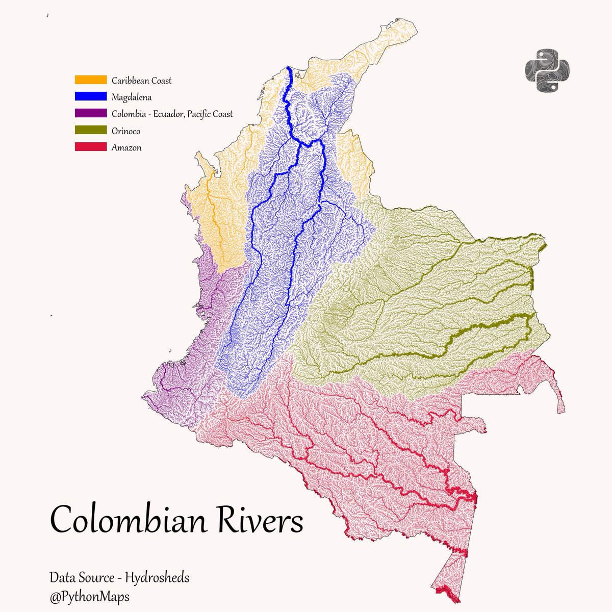
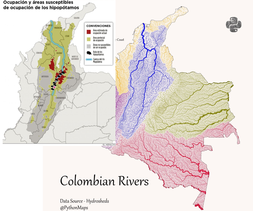
Colombian rivers! Coloured according to their drainage basin, and scaled by discharge. #SouthAmerica #Colombia #Rivers #DrainageBasin #Python #Geography #DataViz


@PythonMaps Hola, nos encantaría tener está imagen en alta calidad para ponerla en el Jardín Botánico del Magdalena, cómo podríamos acceder a ella?

@PythonMaps Where do you get the data from for all those river maps? Really cool.

@PythonMaps Básicamente un país más unido ala Cuenca del Atlántico D:

@PythonMaps Hey, really interesting! Could you share the source for these rivers? Basins or direction of flow?

@PythonMaps Lástima que no los cuidamos 🙁 se necesitan muchas campañas educativos para concientizarnos del grave riesgo en el que estamos si los seguimos maltratando


@PythonMaps De manera que la mayor parte del Chocó está en la cuenca del Caribe.

@PythonMaps What about making a map out of this kind of data for Colombia and why not other lands like USA

@PythonMaps @N_CastelblancoM ¿Qué limita que los hipos pase a la cuenca del Orinoco y/o del Amazonas?


@PythonMaps Ok estos mapitas me estan gustando mucho... Uno Especificando Valores Numéricos de ELEVACIONES POR FAVOOOOOR!


@PythonMaps Cómo dijo Eduardo Galeano....las venas abiertas de América latina


@PythonMaps Un mapa excelente sobre la hidrografía colombiana.


@PythonMaps The east upper zone is also part of the Caribean sea 'cause it goes to the Maracaibo golf at Venezuelan coast, they are the rivers of North Santander departament.

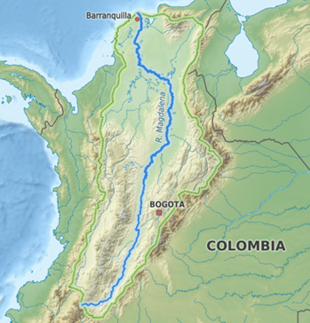
@PythonMaps The blue one is the Magdalena & Cauca rivers basins… the Cauca river is also important 💦💪🏼


@PythonMaps @hipdead010 and my lector told me ,that wat u show, is this....ask the giver? that gave u, that drawing, no topo grafic. map