flatgeobuf @flatgeobuf
A performant binary encoding for geographic data based on flatbuffers github.com/flatgeobuf/fla… Joined April 2019-
Tweets272
-
Followers793
-
Following53
-
Likes132
Finally got some time to take the new @flatgeobuf support in FME 2023 beta for a spin. Sorry @shapefiIe, this thing seems pretty solid. And fast. 750k features per second on read.
Nice, @flatgeobuf becoming @opengeospatial community standard! portal.ogc.org/files/?artifac… See for my early experiments with FlatGeoBuf bertt.wordpress.com/2022/05/03/fla…
It's klunky, but I find that Flatgeobuf gives me new capabilities and solves a problem that isn't easily-resolved via geojson, mvt or the like. It's a good file-format.
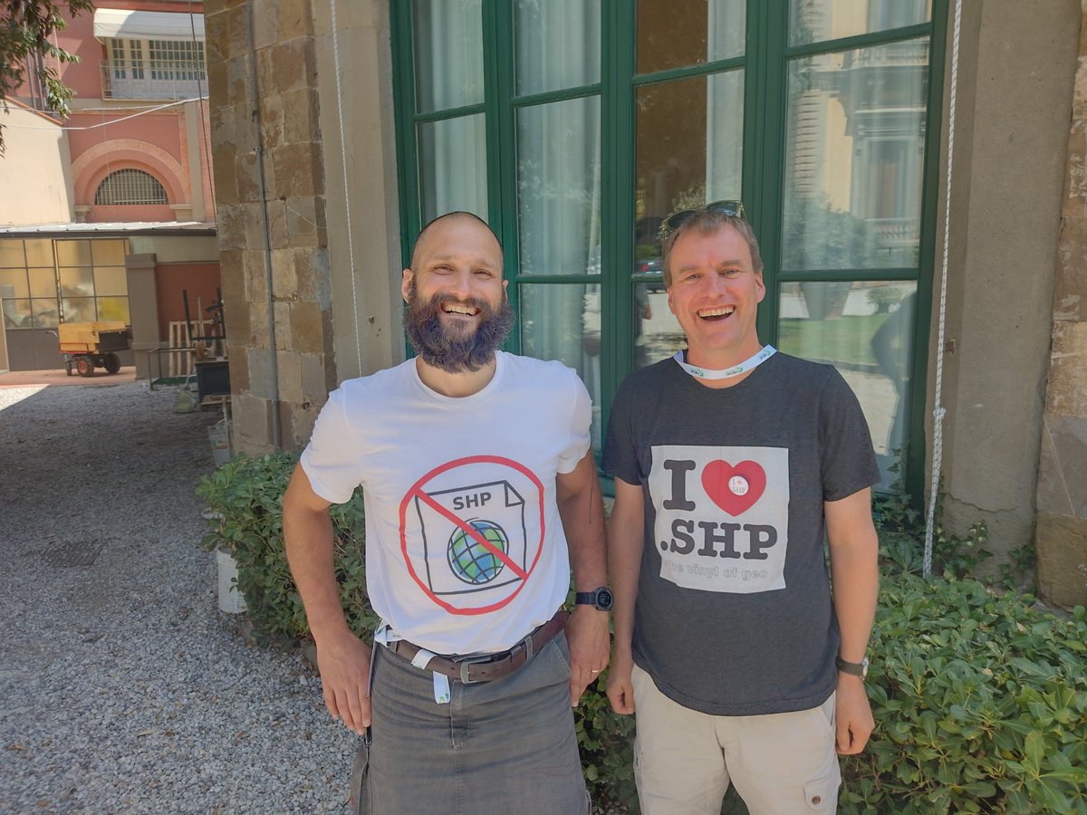
To @shapefiIe or not to @shapefiIe ? That is a question...
new Observable notebook: Spatial query on @flatgeobuf 8 million cadastral parcels datafile (4GB) hosted on @Azure blob storage and visualize in @Leaflet observablehq.com/@bert/flatgeob…
New blog - demonstrating visualizing in QGIS 10 million parcels - format FlatGeobuf (4GB) directly from cloud server bertt.wordpress.com/2022/05/03/fla…
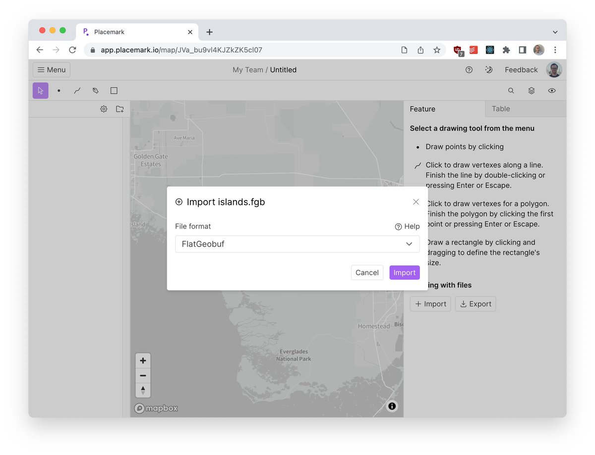
Fresh new import format: @flatgeobuf! An efficient, fancy, modern alternative to formats like GeoJSON & Shapefiles.
Follow detailed steps to configure MapServer for accessing @flatgeobuf as well as for WFS output of FGB : mapserver.org/input/vector/f… #foss4g #sharing cc @shapefiIe
@bjornharrtell @kylebarron2 @benmschmidt @flatgeobuf @GeoPackage1 For me FlatGeobuf is also clearly the first cloud-native vector format, as it was designed for http range requests. It's set a very high bar for all that's needed to be a modern spatial format, especially the big investment in the 'ecosystem' of tools to support it.
While @GeoParquet looks cool and fast (but not spec stable) it's not on Twitter, I'm not sure that is ok for a spatial format? :D
This session is happening in 50 minutes! Lots of great talks on GeoParquet, which just got a 0.2 release (). Do also check out the talk on @flatgeobuf from earlier today for the full cloud-native vector picture: drive.google.com/file/d/1Yd9lfX… #cloudnativegeo
This session is happening in 50 minutes! Lots of great talks on GeoParquet, which just got a 0.2 release (). Do also check out the talk on @flatgeobuf from earlier today for the full cloud-native vector picture: drive.google.com/file/d/1Yd9lfX… #cloudnativegeo
Don't miss an opportunity to learn about #CloudNative #Geospatial on April 19 and 20 during our two day Outreach Meeting. See the full agenda: na.eventscloud.com/website/36829/
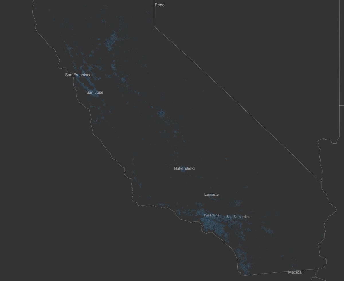
I've added basic @flatgeobuf support to the @protomaps tippecanoe fork which you can try out now: github.com/protomaps/tipp… test dataset: Microsoft California Building Footprints (~3.6GB) reading GeoJSONSeq: 75 seconds reading FlatGeobuf: 10 seconds!
Got some more @flatgeobuf notes to share: worace.works/2022/03/12/fla… This is a more detailed implementer's guide covering topics I wished I knew when writing a GeoJSON -> FGB encoder. Useful for anyone trying to get into the nuts and bolts of how it works.
I recently got to spend an amazing week at @gradientretreat and I used it to dig more deeply into @flatgeobuf which I think is very cool. Now I'm back home and getting around to publishing some of my findings: worace.works/2022/02/23/kic…
@Omojasola6 @maplibre @flatgeobuf The buildings are just osm extracted through the QGIS plugin QuickOSM and just loaded as flatgeobuf. The point cloud I just took from the deck gl tutorial and moved it's anchor. I might have some time for a tutorial soon, but there are a few waiting before that.
Preparing some demo apps for work and this is amazing: used @maplibre & deck.gl to draw a point cloud and figured why not add some extruded buildings. added ~4,400 buildings from OSM each with 98 fields. The layer is in @flatgeobuf and the map loads in ~2 seconds.
@geonanayi If I don't need to edit, I'll always use @flatgeobuf for its speed, size and it's ability to stream.
@drzax Glad to have helped. Will the public spot them in action in an upcoming article? cc @flatgeobuf - another satisfied customer 🎉
Are you using GeoJSON today as the means to transfer data from your backend to your frontend today? Then I could save you ~10x the work and time as a drop in replacement.

Kyle Barron kylebarro... @kylebarron2
3K Followers 673 Following Creating the next generation of geospatial data tools for Python & the browser with GeoArrow, GeoParquet & GeoRust @developmentseed | he/him 🌈
Qiusheng Wu @giswqs
46K Followers 4K Following Associate Professor @UTKGeography | @Amazon Scholar | Talk about #opensource #geospatial #dataviz #EarthEngine
Bert Temme @berttemme
2K Followers 881 Following https://t.co/tt4Ui0vnSr https://t.co/ggaTk0uHt7 https://t.co/IRmVNcwX2e
Chris Holmes @opencholmes
4K Followers 144 Following Working towards Cloud-Native Geospatial, through involvement in @GeoParquet, @planet, @STACSpec, @cogeotiff, @cloudnativegeo & @source_coop.
Volodymyr Agafonkin �... @mourner
15K Followers 1K Following Engineer at @Mapbox, creator of @LeafletJS, open source enthusiast, algorithms geek, speaker, musician @obiymydoschu, baker, father of twin girls, Ukrainian
Robin Cole @robmarkcole
11K Followers 4K Following Tackling the worlds toughest challenges with AI & ML applied to satellite & aerial imagery https://t.co/QmbOWgdfAZ
Topi Tjukanov @tjukanov
20K Followers 2K Following Makes maps. Works at @Mapbox. Started #30DayMapChallenge.
@rjhale1971@fosstodon... @rjhale
4K Followers 3K Following Owner of @northrivergeo . Enjoys adventuring, canoeing, and long walks on the beach while fixing data. #QGIS #POSTGIS #GDAL #GEOSERVER #CHATTANOOGA #HASHTAG
Cloud Optimized GeoTI... @cogeotiff
2K Followers 11 Following I like to say that I'm like a regular GeoTIFF but in reality, I'm way better! Not a big fan of @JPEG_2000 #TeamCOG - gdal_translate -of COG
Kurt Menke - @geomenk... @geomenke
8K Followers 2K Following Danish Resident 🇩🇰 | @SeptimaDK | FOSS4G user/advocate/educator | Author: Discover QGIS 3.x 2nd Ed. | Co-author:QGIS for Hydrological Applications 2nd Ed.
Robin Hawkes @robhawkes
13K Followers 1K Following 🐙 DataViz at @OctopusEnergy ⚡️ Obsessed with maps and energy ✨ Creator of @ViziCities 👨💻 Previously @WoodMackenzie & devrel @Mozilla
Ryan Abernathey @rabernat
7K Followers 2K Following Scientist and Startup Founder Co-founder and CEO @EarthmoverHQ @pangeo_data steering council member ex-Professor @columbia @lamontEarth
Chris Whong @chris_whong
7K Followers 3K Following Urbanist, Technologist, Datahead. Into #dataviz, #opendata, #webmapping and making cities better. Dev Evangelism @mapbox
Cesium @CesiumJS
11K Followers 9K Following The Platform for 3D Geospatial. Tile, visualize, contextualize, and analyze your 3D data. #3DTiles #WebGL
Mykola Kozyr 🇺🇦... @MykolaKozyr
1K Followers 852 Following #StandWithUkraine Space-tech and geospatial. Product at @satellitevu. Earlier - @UP42_ @eos_da Views are strictly my own.
stevebennett@mastodon... @stevage1
2K Followers 2K Following Mapbox and map data guru for hire. Built https://t.co/BtEcWXvN0e https://t.co/ieR4m49pb7 More: https://t.co/Rb0HWGkeij [email protected]
David Bitner @bitnerd
1K Followers 899 Following @[email protected] Ultra Runner/Coach/RD - https://t.co/9E0DB36yyr Geo/FOSS/Database Dev https://t.co/mt0C9HPd8q & https://t.co/Zy70ik22sp he/him
Jeff McKenna @mapserving
6K Followers 3K Following Co-founder of FOSS4G, Director of GatewayGeo, President Emeritus of OSGeo. Sharing maps with MapServer & MS4W, offering support-dev+generally having fun in life
Joshua Yardy @josh_yardy
8 Followers 281 Following
Michael Haberler @mhaberler1
601 Followers 2K Following nethead emeritus || Vorstand, Misanthropes United
Toateesir @ToateesirZsnS3
39 Followers 747 Following
MP @Teste123mkp
0 Followers 225 Following
Matthew Powers @neapowers
290 Followers 168 Following Spark / DataFrame nerd. Helping Latin@s / Brasilians in tech. Blog and write open source to make ppl more productive.
Soki Kimura @sokim39
130 Followers 182 Following Urban Planner 🇬🇧🇯🇵 / spatial data and urban design / デザインと都市と地図 / MA Urban Design @SSoA_news / USS '24 @CASAUCL
Chapin @HiChapin2018
142 Followers 2K Following
Necip Enes Gengeç @negengec
588 Followers 5K Following Data Scientist @getir, PhD from @itu1773 studying on spatial data processing with #AI #GIS #ML.
Nuki Adit @Nwky_
39 Followers 100 Following
robindang @1215747aba2123
3 Followers 3K Following
Anas Shakra @asha8484
25 Followers 1K Following
Grady Joseph @grady679
432 Followers 1K Following helping local governments manage disasters. 🇺🇸/acc former @fema and @caloes now building the emergency management platform of the future @disasters_io
@chiubaca.com @chiubaca
529 Followers 2K Following
Etched Traumas @EtchedTraumas
1K Followers 3K Following Etched Traumas is a non-profit netlabel oriented to ambient / experimental / noise genres. All impulses escape stereotyping! https://t.co/YPo03DXtlV
Stefan Zaunseder @mrbigbunbury
109 Followers 236 Following TUM ComputerScience GISCAD_Technologies SoftwareDevelopment GeographicInformationSystems GIS LandshuterHochzeit Schlaraffia @[email protected]
🇨🇦 @KevinBCrichlow
211 Followers 1K Following Professor - Canadian Military Geomatics Technician Program / Systems Thinker / GEOINT Practitioner / Opinions & Decisions on what to post are my own.
Samweli Mwakisambwe @SamweliTwesa
168 Followers 564 Following
Claudio Ortega @claudio_ortega
260 Followers 1K Following
Charles 🇰🇪 @charlsonyango
572 Followers 6K Following 🇰🇪,passionate on increasing returns from smallholder 👩🌾.Works @TaitaTaveta006 , Agri Dep.Catch me @smartagricare- ag tweet @unimelb alumni.Views are my own
Tatiana Pará @tati_para
2K Followers 3K Following Adoro vir aqui nessa rede reclamar ... por isso tenham paciência! Gosto de Geotecnologias, de política e educação.
Kyle Griffin @kgriffin0
978 Followers 2K Following Meteorologist, homebrewer, FMFC, CFC, US Soccer fan. Data data data. PhD in WI (@UW_AOS) via NY (@UAlbanyDAES) from VA. @kgriffin on the other blue side
Jonathan Chemla @jo_chemla
1K Followers 5K Following CTO @ Iconem Playing with city-scale 3d scans & maps, gis, real-time rendering, OSS/open-data ❤️ activating @[email protected] | @jochemla.bsky.social
Raul @raulnss
44 Followers 312 Following
Ramneek Singh @umbersar
27 Followers 549 Following Interests keep changing. Expert in nothing. Indian classical music lover.
martibosch.bsky.socia... @mortybosch
368 Followers 2K Following Doctor in Civil and Environmental Engineering @EPFL - Urban climate, Python, and a bit of landscape ecology and complexity - Ho sento molt @martibosch@fosstodon
Dee Gee @_grilligan
115 Followers 3K Following
Luca Baggi @baggiponte
534 Followers 2K Following 📈 AI Engineer @ https://t.co/Du2lQ9AFgU 🗞 Ho scritto spiegoni @ilpost 🎓 MSc Econ & Stats @LaStatale 🎓 BA Filosofia @UniBergamo & @SorbonneParis1
VonCannonTech @VonCannonTech
4 Followers 113 Following Software Shop. Mostly making private (E2EE), rugged, fast outdoor maps!
the lloyd center park... @asphaltstrata
24 Followers 823 Following Lloyd Center is a community-centered mall where people from across the region come to shop and dine, and is home to great Portland traditions such as the Portl
Liam Morgan @__LMorgan
29 Followers 274 Following Environmental consultant with a focus on geospatial analysis for landform rehabilitation
Jeremy @GeoFriday2019
117 Followers 977 Following Extension in Agriculture and Natural Resources AgTech for Small Farms, GIS, remote sensing, R, drones, lidar, agroforestry
Sid8 @tw8_sid
153 Followers 798 Following Data Platform Engineer, Ex-Ola, Ex-Kawa Space Working on my startup https://t.co/qvnugBgRFQ https://t.co/CjeBj6NPki
Dionisio Agourakis @josaum
376 Followers 2K Following Co-Founder and CEO of @getjaiofficial - Hire AI Workers for your business today. I like vector embeddings and negronis.
Robbert Van Cauteren @robbertvc_
8 Followers 439 Following
May Lim @cxteam_lim
850 Followers 878 Following Professor at UP Diliman, National Institute of Physics. @[email protected] @mtlim.bsky.social
Kyle Barron kylebarro... @kylebarron2
3K Followers 673 Following Creating the next generation of geospatial data tools for Python & the browser with GeoArrow, GeoParquet & GeoRust @developmentseed | he/him 🌈
🥔🗺️ ᴘᴏᴋ... @pokateo_maps
28K Followers 3K Following po-KATE-o, first of her name, eater of potatoes 🥔 and maker of maps 🗺️. I make GIS (more) fun by sharing maptastic themes & original mappy memes! 🌐 ᵛᶦᵉʷˢᵐᶦⁿᵉ
Chris Holmes @opencholmes
4K Followers 144 Following Working towards Cloud-Native Geospatial, through involvement in @GeoParquet, @planet, @STACSpec, @cogeotiff, @cloudnativegeo & @source_coop.
Paul Ramsey @pwramsey
7K Followers 232 Following Please find me at @[email protected] @pwramsey.bsky.social
Topi Tjukanov @tjukanov
20K Followers 2K Following Makes maps. Works at @Mapbox. Started #30DayMapChallenge.
@rjhale1971@fosstodon... @rjhale
4K Followers 3K Following Owner of @northrivergeo . Enjoys adventuring, canoeing, and long walks on the beach while fixing data. #QGIS #POSTGIS #GDAL #GEOSERVER #CHATTANOOGA #HASHTAG
Cloud Optimized GeoTI... @cogeotiff
2K Followers 11 Following I like to say that I'm like a regular GeoTIFF but in reality, I'm way better! Not a big fan of @JPEG_2000 #TeamCOG - gdal_translate -of COG
Kurt Menke - @geomenk... @geomenke
8K Followers 2K Following Danish Resident 🇩🇰 | @SeptimaDK | FOSS4G user/advocate/educator | Author: Discover QGIS 3.x 2nd Ed. | Co-author:QGIS for Hydrological Applications 2nd Ed.
fosstodon.org/@klaska... @klaskarlsson
7K Followers 82 Following SwAF working with geosupport in the field and in systems developement. Here I mostly write about things that interest me when I'm not at work. Open Sources.
gdal org @GdalOrg
4K Followers 6 Following No longer here. Find us at @[email protected] GDAL is a translator library for raster and vector geospatial data formats.
Jeff McKenna @mapserving
6K Followers 3K Following Co-founder of FOSS4G, Director of GatewayGeo, President Emeritus of OSGeo. Sharing maps with MapServer & MS4W, offering support-dev+generally having fun in life
Gary Sherman @shermange
3K Followers 71 Following Founder of QGIS project, developer, author of technical books as well as fiction (https://t.co/oyBJ4MEYEu). Former publisher at https://t.co/QoMKJxVKy6.
The Real GeoServer @GeoserverO
2K Followers 28 Following Proudly brewing geospatial data and maps since 2000. Free and Open Source!
Karsten Pihl @KarstenPihl
73 Followers 119 Following
Martin Bjærge Jensen @kukkaide
522 Followers 4K Following
@ianturton@fosstodon.... @ijturton
1K Followers 898 Following Part time employee of @astuntech but they don't support anything I say. Former Professor of Cruel and Unusual Geography he/him/dr buy at https://t.co/yvpr806Vz4
Jody Garnett @jodygarnett
2K Followers 310 Following Open source geospatial contributor with @osgeo and @locationtech communities. Projects include GeoTools, GeoServer, JTS, ImageN and uDig.
Stefan Keller @sfkeller
2K Followers 326 Following Prof. Data Engineering and GISTech @OST_Informatik. Director @IFSRapperswil. Data Scout and Enabler - Formerly "Open Whatever"! [email protected]
Matthias Kuhn @_mkuhn
1K Followers 319 Following Managing geoninja at https://t.co/QMp9HKke60. Developping QGIS and QField.
Mats @mats_cgo
230 Followers 2K Following
Thomas Gratier - @Tho... @ThomasG77
3K Followers 5K Following Freelance SIG libres, OSM & OpenData /w JS & Python. Auteur livre OpenLayers. Pro @webgeodatavore + https://t.co/eriVmUePcG Coopère @ouvreboites44
James Fee @cageyjames
8K Followers 2 Following I’m no longer here. RIP Twitter -- https://t.co/8kOYEPAegb
Thomas Knudsen @busstoptaktik
201 Followers 1K Following @[email protected] Misantrop, Geodæt, Ph.D.
FOSS4G 2024 | https:/... @foss4g
18K Followers 591 Following The world’s largest gathering of open source geospatial users, developers, and researchers. FOSS4G | https://t.co/wtkKL1RgOW
Silvana Camboim @silcamboim
637 Followers 1K Following Cartographer. Professor at Universidade Federal do Paraná - Brasil. Open Source, Data, Maps, Science and Minds.
Paul Blottiere @pblottiere
190 Followers 244 Following #QGIS core and server committer | #QGIS Voting Member | Member of the @CooperativeQ | Lead Software Engineer @HytechImaging
Mikael Månsson @MadMansson
134 Followers 167 Following Geographer at Sweco with an addiction for technology. FME Certified (Pro, Server & Trainer)
@asgerpetersen@mastod... @Asgerpetersen
350 Followers 302 Following
Sourcepole @sourcepole
1K Followers 15 Following Geospatial solutions with Open Source Technology. @QGIS, GDAL/OGR, @OpenLayers, @PostGIS and more. @[email protected]
Henrik Larsson @Kartogishenko
57 Followers 209 Following Small municipality GIS manager and land surveyor. Bald and boring. Only in it for the coffee.
Gabriel Roldán @gabrielroldan
218 Followers 165 Following
Nicklas Avén @NicklasAven
282 Followers 564 Following
Gregers H. Petersen @GregersP
533 Followers 1K Following Vendelbo i Virum. Elsker AaB. Civilingeniør/MScE. Co-founder of @SeptimaDK. @OSGEO Charter Member. Husband to @Ceciliec91. Father to KS. Homebrewer.
John Wika Haakseth @haakseth
272 Followers 553 Following 🇳🇴 in 🇩🇰 Web Developer at @SeptimaDK 💻 🏐 🎸 🐶 @[email protected]
Lars Ellebjerg @Lars_Ellebjerg
26 Followers 42 Following
Atanas Entchev @atanas
2K Followers 472 Following
Björn Harrtell @bjornharrtell
237 Followers 50 Following Geospatial software architect and developer happily working at @SeptimaDK. ❤️ #postgis, #openlayers and good collaboration.
Nathan Woodrow @madmanwoo
3K Followers 411 Following QGIS core developer, python-dev, father, miniature painter, board gamer https://t.co/z7Y1aUX7dJ 🏳️🌈
OSGeo https://fosstod... @OSGeo
30K Followers 186 Following The Open Source Geospatial Foundation... search for our local chapters around the world as well. See you at https://t.co/mCjhOCQaoy
Find me on Bluesky @KiriCarini
3K Followers 741 Following
N. Frank Warmerdam @nfwarmerdam
765 Followers 73 Following GDAL/OGR Founder, OSGeo Member, Geospatial Geek
@[email protected] @howardbutler
5K Followers 2K Following Point clouds. Open source. PDAL, GDAL, Entwine, https://t.co/7SpD598uPq, libspatialindex, and others. non-contributor corporate entity leading @hobuinc
Christian Fischer @Fischer_Septima
135 Followers 213 Following

