Search results for #PhotoMappers
@JonTheStormGuy Salute 🫡 & hat tip for including location. #PhotoMappers
@matthewfultztv @WTHRcom Can you share the location or street of this damage so it can be mapped by the #PhotoMappers team for emergency managers, please? I understand if not. Thanks. 🙏
@MichaelVan_News @FOX59 @CBS4Indy Can you share the location or street of this damage so it can be mapped by the #PhotoMappers team for emergency managers, please? I understand if not. Thanks. 🙏
Map of missions since December 2019 to October 2023. My cat was part of me contributing to these. Reminding me to take breaks, eat, walks, and comforting me when it got rough or when I had nightmares. I consider her an unoffical member of the #PhotoMappers team in memoriam.


Four-ish years ago I asked if I could help in a meeting. I had no idea where it would lead. Humbled and grateful to assist during some of the worst times in peoples lives with @GISCorps, @napsgfoundation, & @CEDRdigital. #PhotoMappers #DisasterResponse

Four-ish years ago I asked if I could help in a meeting. I had no idea where it would lead. Humbled and grateful to assist during some of the worst times in peoples lives with @GISCorps, @napsgfoundation, & @CEDRdigital. #PhotoMappers #DisasterResponse

@EmergencyComms @GISPublicSafety @napsgfoundation @fema Are you meaning Social Media when you say sm? If so yes, #PhotoMappers is integrated into the tool to view crowd sourced images from an affected area.

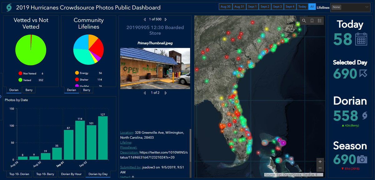
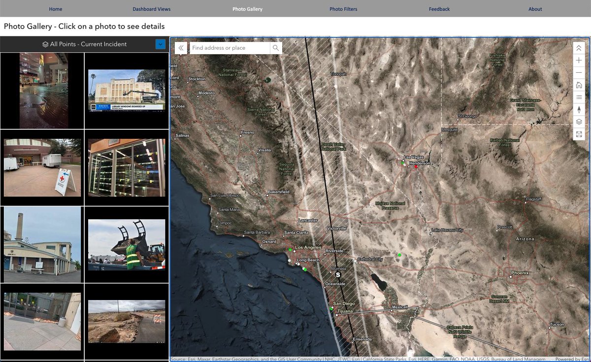
The @GISCorps @napsgfoundation #Photomappers have activated and started mapping photos and videos of the #HurricaneIdalia. This map will continue to populate and help emergency managers assess the damage. #Photomappers Link: experience.arcgis.com/experience/0fb…
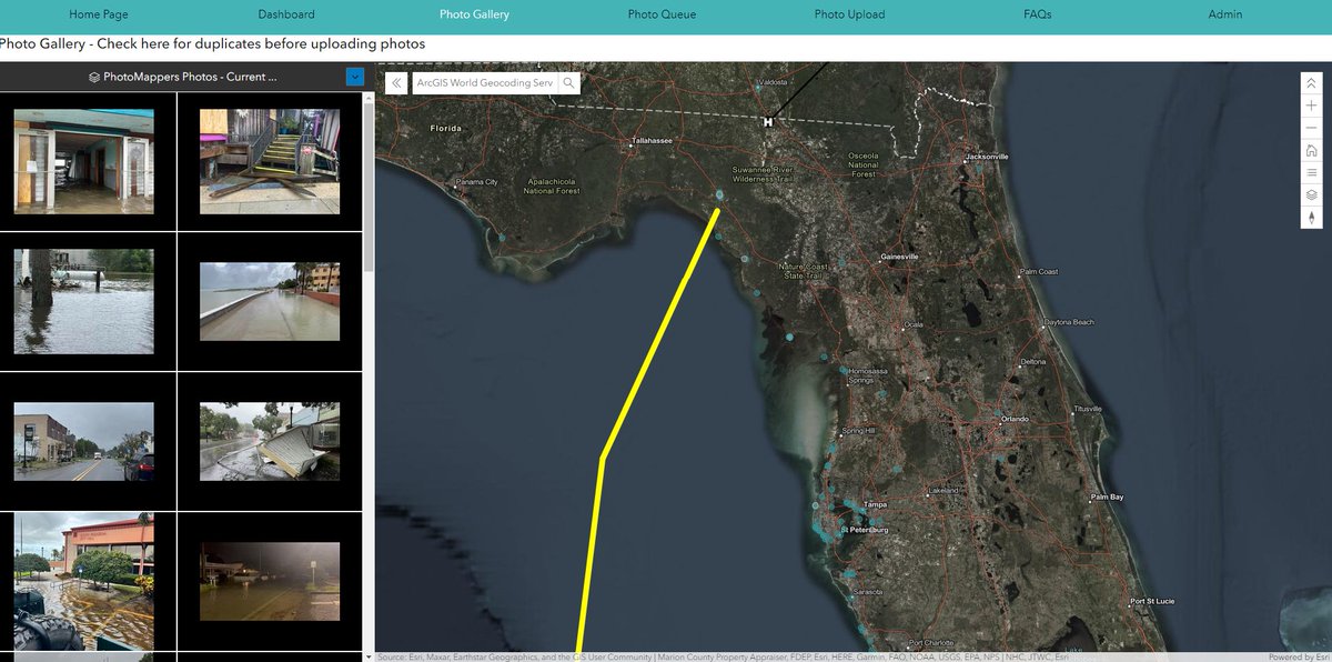
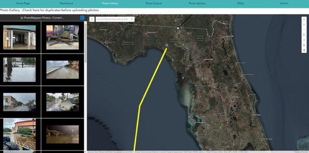
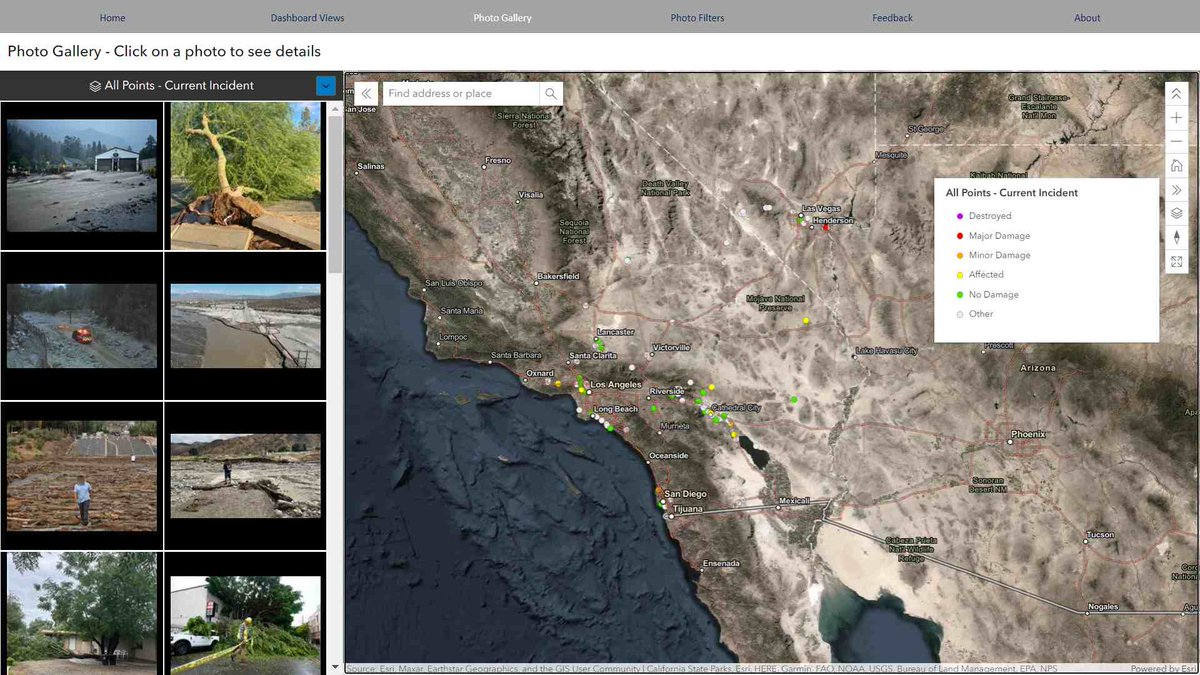
The @GISCorps #PhotoMappers volunteers have mapped photos and videos of TS #Hilary to help response agencies understand the impacts. Access the photo gallery and feature service in the Experience Builder app: experience.arcgis.com/experience/d61… @napsgfoundation @CEDRdigital
@AaronRigsbyOSC @accuweather any idea of the location, street? please thank you @GISCorps #photomappers

#PhotoMappers volunteers are geolocating and aggregating photos from social media and news outlets to monitor the effects of #Hilary. So far it's not too bad, but we know the real impacts likely won't be seen in the United States until this afternoon. experience.arcgis.com/experience/d61…
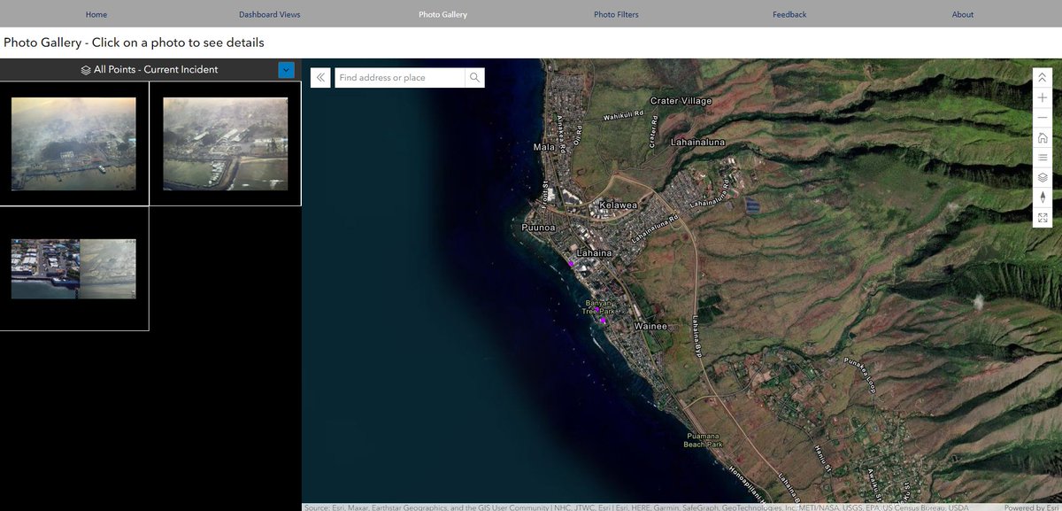
The @GISCorps @napsgfoundation #PhotoMappers have mapped photos and videos of the #MauiFires, starting with #Lahaina. This map will help emergency managers assess the damage. Photo Gallery Link: experience.arcgis.com/experience/d61… #Wildfire #PhotoMappers #DisasterResponse


The @GISCorps @napsgfoundation #PhotoMappers have activated and started mapping photos and videos of the #MauiFires, starting with #Lahaina. This map will continue to populate and help emergency managers assess the damage. experience.arcgis.com/experience/d61…

PhotoMappers @PhotoMappers
14 Followers 50 Following PhotoMappers is an awesome photography magazine for those who want to improve their photography. We make you a better photographer. Period.
Keith Johnson @KeithJGw
436 Followers 712 Following Volunteer for this & that, & GISCorps #FireMappers https://t.co/DYzastenGj #PhotoMappers https://t.co/8v25uNswtX #CrisisCommunicationCatalog https://t.co/oufZgsXhjl #GISforGood Tpyos Free
German Whitley @Mgermancvo
245 Followers 1K Following https://t.co/7mwLgl9TOq, Wildfire GIS, Hydrologist, Nerd, CERT member, #FireMappers, #PhotoMappers