R spatial @geospatial_r
A twitter account for #rspatial community that retweets everything about #rspatial, #geospatial, #GIS, #remotesensing, #rstudio, #rstats. Joined November 2021-
Tweets94
-
Followers149
-
Following24
-
Likes15

What would happen in Europe if the sea level raises 50m? A "what-if" map, made with {elevatr} #RStats #rspatial

Today's #rstats cheatsheet: shiny Download: raw.githubusercontent.com/rstudio/cheats… See more: rstudio.com/resources/chea… Contribute your own: github.com/rstudio/cheats…


The {regional} package calculates intra-regional and inter-regional similarities based on user-provided spatial vector objects (regions) and spatial raster objects (cells with values). Learn more at jakubnowosad.com/regional/. #rspatial #rstats #gischat


Sorry @milos_agathon , today is my turn! (Although probably you already made this map). Life expectancy at birth, 2019. Made with #rspatial following this blog post: milospopovic.net/inset-graph-wi…


I updated the website of my book "Geospatial Health Data" with the bs4 #bookdown template🌎📊💻Ready to teach in @ENAR_ibs! ✈️ 👉 paula-moraga.github.io/book-geospatial 💻#rstats #rspatial🗺️#diseasemapping #GIS ✨#rshiny📊#RINLA 🌍#spatialepidemiology 🌈#epitwitter 📕 @CRC_MathStats


7/n I ran the same survey for R. Guess what! 90% love RStudio. So it’s simpler to pick R. Everyone uses RStudio. We all learn the same way. But that’s just the 2nd reason.


🤔How do others use ds in your industry? 🙋🏼♀️How do you start a meetup at your company? This site has been an idea for a while & makes me so happy to share. Lmk what you think. I'd love to keep adding resources (blogs, meetups, tips) from all♥️ rstudio.com/champion/ #rstats

Good things are in the works...stay tuned! @locatepress


GDAL 3.4.2 is released: lists.osgeo.org/pipermail/gdal…


I'm *soooo* close to wrapping up the development sprint I've been on for the last month. I've made several new mapping functions that I split off into a separate {birdseyeview} package (mainly to keep #overedge from getting too complex) elipousson.github.io/birdseyeview/r… #rspatial


#rspatial Do we need a package for using our own pictures as base maps? I don’t know, but anyway we have it! {rasterpic} 📦 is now on CRAN, and we can convert our pngs to spatial rasters like this cran.r-project.org/package=raster…


BAM! Thanks so much @TimSalabim3 for helping with this. I can't quite get over how well this works! >1million lines rendered in the browser (v fast) with no lag at all. Issue was some broken geometries and needing to add the src=TRUE arg in leafgl::addGlPolylines. #rspatial

BAM! Thanks so much @TimSalabim3 for helping with this. I can't quite get over how well this works! >1million lines rendered in the browser (v fast) with no lag at all. Issue was some broken geometries and needing to add the src=TRUE arg in leafgl::addGlPolylines. #rspatial https://t.co/kYry8DGQT4


So the #rspatial workflow would be to tile first, load each tile separately and then process? I’m not sure about this because I am trying to classify the imagery with one set of samples for training and validation. Would I have to have individual samples for each tile? Thanks!

DavidAtinga @Atinga__David
0 Followers 13 Following
YugoNuramtomo @JugoNoer
2 Followers 59 Following
Pulakesh Pradhan @codeforgeo
63 Followers 324 Following PhD Scholar, MPhil, UGC-SRF, WB-SET, AIU National Participant. (Focus Area: Climate and Agriculture)

Jérémy Bacon 🇹�... @jeremy_bcn
40 Followers 147 Following Doctorant au sein du @LEHNA_lab 🌿🌍 🇹🇫🧊Communautés végétales aquatiques des Iles Kerguelen (Subantarctique) en contexte de réchauffement climatique
Dennis Chavarría @dnschavarria
361 Followers 3K Following Geógrafo, Cartógrafo, Analista en Sistemas de Información Geográfica y Teledetección / Geographer, Cartographer, Analyst in GIS and Remote Sensing
Roberto Ragno @ragno_roberto
89 Followers 249 Following PhD @unibait, Interested in quantitative approaches to 1st millennium CE Environmental Arch.
Lokergeo @lokergeo
2K Followers 837 Following Berbagi lowongan pekerjaan, studi berbeasiswa, dan informasi terkait lainnya di bidang geospasial 🗺🌏🛰. Punya info? Silakan mention atau DM ya!
Pierre-Yves Louis @pylouis
453 Followers 4K Following

robindang @1215747aba2123
3 Followers 3K Following
DNDPhuong @DNDPhuong
13 Followers 949 Following
Ntombifuthi Blose @Ntombi_J_Blose
9 Followers 193 Following Health Systems Trust | CERI | SACEMA Data Scientist | Epidemiologist | Evidence-Based Medicine Methodologist | Public Health Specialist
Sebastian Seb @SebastianS11452
1 Followers 51 Following
M4RCUS @check_mate_001
38 Followers 1K Following
Daniel Mc Dermott @damcderm
266 Followers 758 Following MRC-DTP student @ LSTM & Lancaster University | Bridging the Ento/Epi gap in Malaria control | Will sell my soul for old maps of the world |
Geospatial@Wayne @WayneStateGIS
152 Followers 722 Following Geospatial education and learning community at Wayne State University #DetroitGISday
Anuj Sharma @AnujSha31081220
17 Followers 105 Following
Amod Pokhrel @Amodpokhrel
8 Followers 32 Following

gil.eo💰🔭🌍�... @gamponsahKakabo
212 Followers 948 Following Remote Sensing and GIS, Forest Ecology, Land Cover Mapping, Climate Change, tennis🎾addict

Mandela Houngnibo @hmandela
59 Followers 246 Following
Reto B. Cola 🦋 @co... @RBC_ola
57 Followers 208 Following Neuroscience PhD student with a passion for baseball and the mountains
Simon Kuestenmacher @simongerman600
258K Followers 216K Following German #geographer and #demographer in #Melbourne. I curate #maps and #data that explain how the #world works. Obviously all opinions are my own...
Dr. P.S. PAWAR @pspawar71
2 Followers 26 Following
Jean Golay @JeanGolay1
1 Followers 27 Following
... @andyvongrimes
33 Followers 633 Following
Dr. Wei Xu @xuwei_evo
72 Followers 280 Following Postdoc of IRD, France. Ecology, Evolution, Tropical Rainforest, Conservation, Climate Change, Vertebrates, Extinction, Functional Diversity.
hugo rr @hugo_rubilar
37 Followers 170 Following Formerly Planeteer, Firefighter, Marketing Auditor, Ecologist, GIS specialist at the big Apple ;)
Petra Schoon @schoon_pl
3 Followers 64 Following
Kaleem Mehmood Kamilk... @Kaleemkamilkhel
168 Followers 2K Following 🔬 Environmental RS | 🌍 Climatic Change | 📊 Data Science
Sayon Ghosh @sayonghosh22
138 Followers 1K Following Research scholar of forest economics Purdue University
Chris @_Chris_Larkin
80 Followers 133 Following PhD Researcher @GeospatialCDT | Cycling, networks and spatial data | https://t.co/jHB0DxvjIX
Argosax @argosayax
14 Followers 324 Following
Climate change scient... @AntonyKaduuma
186 Followers 2K Following I do spatial analysis using open source software for examples Rstudio and Qgis
RAHUL @RAHUL_KANANI
71 Followers 797 Following
Norman Rauthe @RautheNorman
2 Followers 37 Following
Sawaid Abbas @SawaidAbbas
259 Followers 1K Following Research Assistant Professor|The HK Polytechnic University|Remote Sensing|Geospatial|Environment|Forest|Regeneration|Land Cover|Hyperspectral|BigData

Charles Cunningham @CA_Cunningham
81 Followers 205 Following Postdoctoral Researcher investigating connectivity and biodiversity in @UK_Treescapes at @UniofYork

Roman Krtsch @roman_krtsch
136 Followers 314 Following Postdoctoral researcher in Political Science @uni_tue | interested in Protests and Contentious Politics
Omer Raz @_spez_
4K Followers 2K Following פודקאסט האורבניסטים (יש לינק פה למטה) מהנדס ומתכנן שמתמחה בסביבה ושינויי אקלים PhD at Bartlett School of Environment UCL Intrested in Transport and China
Paul Bidanset @paul_bidanset
22 Followers 34 Following Ph.D. Candidate | Founder @ Center for Appraisal Research & Technology (CART) | Valuation, AVM, and Property Tax Researcher |
anna_candotti @anna_candotti
20 Followers 114 Following
Tito Kibona, PhD @TitoKibona
539 Followers 1K Following Veterinarian|Biomedical Research Scientist (One Health) |full-time Father and Husband
AT_Geomatics @AT_GEOMATICS
273 Followers 922 Following GIS Consultant - Orthoimagery Specialist - Cartography - Data & Research Services - Mapping the Geospatial Journey 🛰🌎🌍🌏🗺🗾 DM for project inquiries.
Francisco Parra @ScienceData1
139 Followers 1K Following Data Science - Machine Learning - Deep Learning
Margarida Mendes-Silv... @Margari59596283
11 Followers 286 Following I'm a researcher and data analyst, working on monitoring and valorizing neglected and underutilized agroforest species.
Rstats @rstatstweet
29K Followers 30 Following I retweet #rstats stuff. Maintained by @justin_ct_ho.
R for the Rest of Us @rfortherest
23K Followers 184 Following You don’t need a PhD in statistics or years of coding experience to learn R, the most powerful tool for data analysis and visualization. Made by @dgkeyes.
tidyverse tweets @tidyversetweets
11K Followers 0 Following Archived and inactive until further notice. I'm a bot that tweets new tidyverse content from StackOverflow and RStudio Community. Not affiliated with @rstudio.
R Development News an... @R_dev_news
586 Followers 4 Following Bot tweeting R development updates from: https://t.co/PrnG5Dg0lP & https://t.co/s1cyYth8la Maintainer: @Lluis_Revilla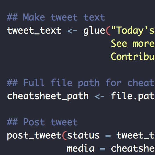
Daily R Cheatsheets @daily_r_sheets
22K Followers 3 Following A Twitter bot that posts a random #rstats cheatsheet each day. Sourced from Rstudio - no affiliation. By @seabbs
We are R-Ladies @WeAreRLadies
30K Followers 171 Following Rotating Curator for the @RLadiesGlobal community #RLadies (currently on a brief break)
Ido Klein עדו קל... @idoklein1
4K Followers 679 Following Three thousand years of beautiful tradition, from Moses to Sandy Koufax YOU'RE GODDAMN RIGHT I'M LIVIN' IN THE FUCKIN' PAST!
Open Geospatial: OGC @opengeospatial
27K Followers 229 Following OGC’s member-community of experts makes location data Findable, Accessible Interoperable, and Reusable (FAIR) through #innovation #collaboration and #standards
OSGeo https://fosstod... @OSGeo
30K Followers 186 Following The Open Source Geospatial Foundation... search for our local chapters around the world as well. See you at https://t.co/mCjhOCQaoy
uRos @uRosconf
654 Followers 91 Following #uRos2025 will be organized on-site, 24-26 November 2025 in Bucharest, Romania!

Geographical Analysis @GeogAnalysis
2K Followers 59 Following Adorable little Journal of Theoretical Geography. We publish on geographical methods, spatial and urban analytics + innovative applications. Editor: @rsfrankl
Urban Analytics Lab @urbanalyticslab
3K Followers 1 Following Research group at the National University of Singapore. Advancing geospatial/urban data, GeoAI & digital twins since 2019. Led by Prof @fbiljecki @NUSingapore
Carlos Cámara-Menoyo... @drccamara
119 Followers 273 Following @carlescamara 's academic account: Cities, technology & #maps with a social perspective. #rstats #gis , Senior Research Software Engineer @CIMethods
The R Foundation @R_F... @_R_Foundation
27K Followers 27 Following Not for profit organization founded by the R Core Team to provide support for the R project. A reference point for interaction with the R development community.
rOpenSci @rOpenSci
32K Followers 474 Following rOpenSci fosters a culture that values open and reproducible research using shared data and reusable software
Plus là @RoelandtN42
1K Followers 728 Following
Cédric Scherer @CedScherer
25K Followers 2K Following Inactive account → find me on BlueSky and LinkedIn 🧙♂️✨📊 Independent #DataViz Consultant & Designer 👨🎓🌿🐗 PhD in Computational Ecology
Posit PBC @posit_pbc
123K Followers 604 Following The open-source data science company for the individual, team and enterprise.
Ujaval Gandhi @spatialthoughts
17K Followers 436 Following Educator | Founder @ Spatial Thoughts | Helping people learn and master geospatial tech - #QGIS, #Python, #GDAL, #EarthEngine | Ex-Google


QGIS @qgis
64K Followers 63 Following Official account of QGIS - the user friendly Open Source Geographic Information System
Jakub Nowosad @jakub_nowosad
9K Followers 163 Following Inactive account → find me on Fosstodon and BlueSky 🌐 Computational geographer. Co-author of https://t.co/Oa9HgB7MLF.Trends for United States
You might like